
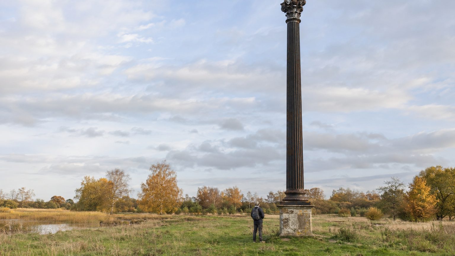
The cast-iron post at Holme Fen, in Cambridgeshire, towers over the passerby today by about 4 meters. In 1851, its summit just broke the surface. No flood or quake: the drying up of a lake caused the surrounding peat to sag.
The stake did not move; it was the ground that sank.
- A lake in Cambridgeshire was drained between 1850 and 1851.
- The peat, deprived of water, compacted and oxidized upon contact with air.
- The ground fell by about 4 m in a century, leaving the column protruding.
A drained lake, agricultural land in its place
Between 1850 and 1851, a group of local landowners led by William Wells, of Holmewood Hall, drained Whittlesey Mere. According to the Holme Fen entry on Wikipedia, steam pumps were used for the operation. In exchange for financing the works, each participant received a share of the drained land, notes the Great Fen site.
The body of water was already little more than a shadow of itself: sediment clogged it and peat expansion further reduced its area, covering less than 1,000 acres (about 400 hectares) with a depth of 3 feet (about 90 cm), according to Wikishire. Groundsure suggests it formed around 500 BCE, when silt from the Nene and Welland rivers drove water away, with dead plants subsequently accumulating as peat.
Before drainage, the sheet served as a place for boating, fishing and, in winter, skating on ice. It also housed Britain’s native population of the swallowtail butterfly, according to Wikipedia. The Great Fen notes that several species, including the large copper butterfly, disappeared once the mere was transformed into agricultural land. The exact timetable varies by source: Historic England’s entry places the drainage between 1849 and 1853.
A wrung-out sponge, a stake to measure it
Wells understood that once deprived of water, peat would behave like a wrung sponge. He wanted a gauge placed at one of the sector’s lowest points, the Great Fen explains, and his own account of the drainage was published in 1860 in the Journal of the Royal Agricultural Society, a reference cited by Historic England.
The risk was not theoretical. Elsewhere in the Fens, drainage had already left land sunken and imposed costly water-management works, such as the Denver sluice, recalls Atlas Obscura. The Holme Fen stakes were meant to show how quickly this flat landscape descended toward the North Sea.
The principle rests on three steps: drive an oak stake through the peat down to the clay, trim its top flush with the ground, then watch the land descend along the wood. Wikipedia attributes the operation to engineer John Lawrence in 1851. The Great Fen places the first wooden stake at 1848, and in 1851 its replacement by a cast-iron column. At that time, the stake lay about half a mile from the lake’s edge, with nearly 22 feet of peat (about 6.7 m) between the surface and the clay.
The column itself sits on another oak stake driven down to the clay.
This fluted, octagonal-based column is thought to be a remnant from the Crystal Palace, the London 1851 Great Exhibition’s hall, according to the Great Fen and Historic England. Its top has been aligned precisely with the old wooden stake so that the measurement could continue without a break. Sources remain cautious on this point and refer to an origin reported or presumed.
Four metres of ground lost
Right after drainage, the ground sank at about 9 inches per year, roughly 23 cm, and the pace remained rapid during the first thirty years. Two mechanisms acted together: peat compacts as it loses water, then oxidizes when exposed to air and crops, Wikipedia notes. The Capturing Cambridge site states that by 1955 the land had already fallen by 12 feet, about 3.7 m. The second column was therefore installed after most of the decline had already occurred.
Today, about 4 m of the column protrude above the ground, according to the Great Fen.
The land did not merely settle. In this fen region, trees and hedges were cleared for mechanized farming, and in dry weather the wind carried away soil from exposed fields, reports the Discovering Britain programme.
Iron guy-wires stabilized the column in 1957 as it became unstable while protruding from the ground, and a second column was planted the same year 6 m to the northeast. Its metal plaques bear the ground levels and the corresponding dates, according to Historic England. Both remain standing, and Historic England classified them as Grade II on 11 August 1988.
Below sea level, among the birches
At the base of the post, a visitor stands 2.75 m below sea level, which the Great Fen presents as Britain’s lowest land point. The reserve, managed by Natural England, covers 657 acres, about 266 hectares. It is part of the Great Fen project, which aims to create a 3,700-hectare wetland, according to Wikipedia. The two columns are visible from the northern road that crosses the site.
The ground freed by the lake is today covered with birch trees. Wikipedia echoes Natural England’s description, which calls it the finest example of lowland birch woodland in Britain and notes around 450 species of fungi. As for the 4 m, that figure is rounded: the same encyclopedia converts it to 13 feet, about 3.96 m, and the Great Fen records the decline from 1852, whereas other sources start from 1851.
Sources: alamy.com | geograph.org.uk
