
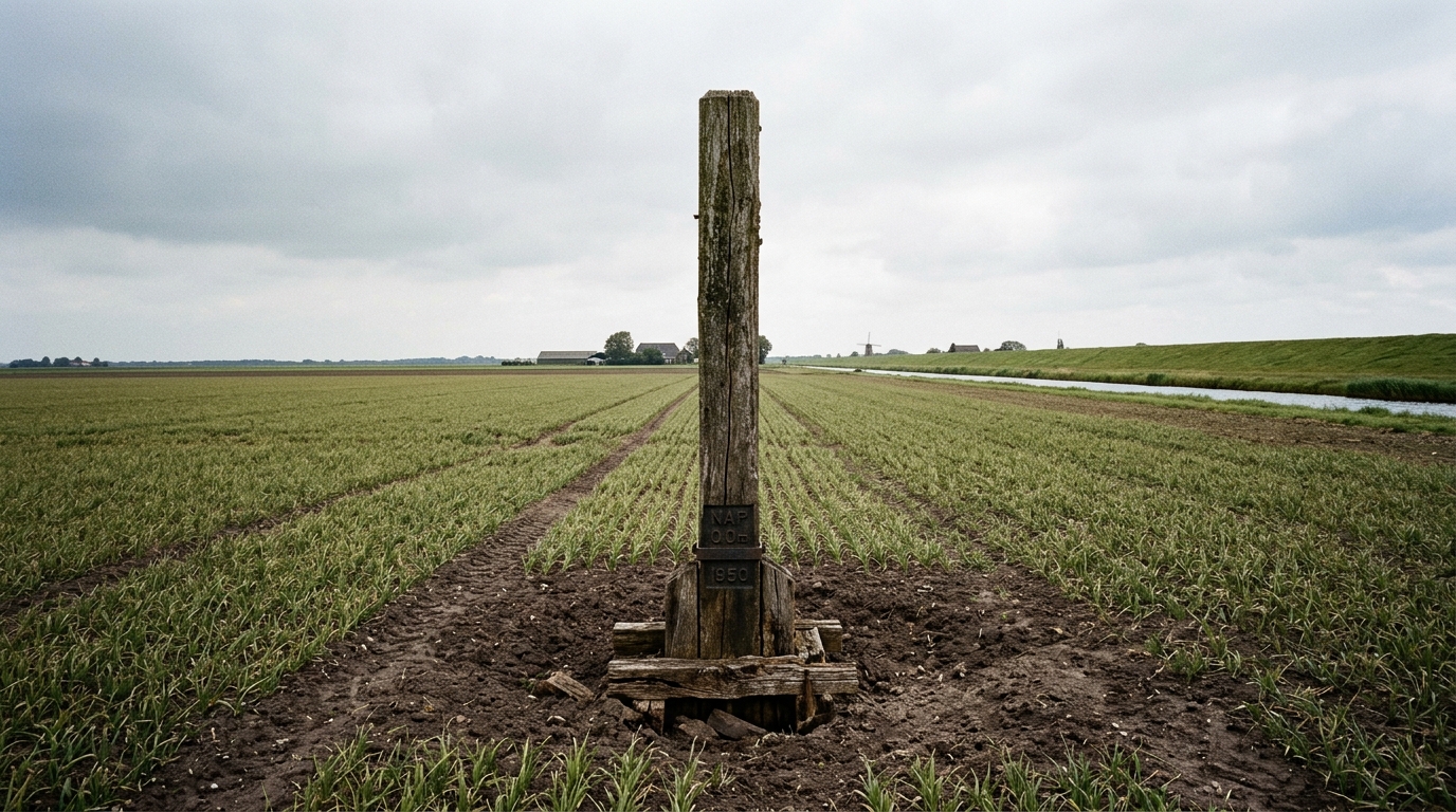
Imagine for a moment planting a ladder into a field, stepping down several rungs, and finding yourself at the level where the ground stood a century ago. That is precisely what has happened in Seeland, this Swiss region tucked between Lake Biel/Bienne, Lake Neuchâtel, and Lake Morat. At the outset of autumn, as harvests reach their peak in this area nicknamed the Swiss vegetable pantry, few realize they are walking on soil that is sinking literally, year after year, the victim of a colossal project started more than a century and a half ago.
- Since drainage began in 1868, the peat soil of Seeland has subsided by 1 to 2 cm per year, with cumulative subsidence reaching up to 2.4 meters in some areas
- Farmland ends up below the level of nearby lakes, and pumping stations operate continuously to expel water and prevent the fields from turning into ponds
- The ongoing oxidation of peat releases CO2 and methane into the atmosphere, making this agricultural region a silent contributor to climate warming
- The audacious gamble that redrew an entire region
- Peat, this living soil that vanishes year after year
- Crops that grow below the level of the lakes
- The Grand Marais facing its own collapse
The audacious gamble that redrew an entire region
It all begins in 1868, when Swiss authorities decide to tackle a recurring problem: the devastating floods that regularly struck the region. The project, known as the Jura Water Correction, involves lowering the level of the three lakes and establishing a vast drainage system to dry up the Grand Marais, a wetland that then stretched across 62.5 km². The aim is clear: transform these waterlogged lands, deemed unusable, into fertile agricultural terroir.
The result exceeded all agronomic expectations. Once drained, the peat that makes up this soil reveals exceptional richness, capable of supporting intensive crops. Even today, a quarter of the vegetables consumed in Switzerland come from this region, evidence that the initial gamble paid off economically. But this agricultural success masks a geological transformation far more discreet, and considerably more worrying.
Peat, this living soil that disappears every year
To understand what is happening beneath our feet in Seeland, one must first grasp what peat truly is. Unlike a conventional mineral soil, it consists of plant debris accumulated over millennia, never fully decomposed due to a lack of oxygen in an waterlogged environment. In plain terms, it is a vast reservoir of organic matter, a natural freezer that has paused decomposition for centuries.
The drainage abruptly reopened this freezer. By exposing peat to oxygen, the hydraulic works triggered a continuous oxidation process, invisible to the naked eye but relentless. Result: the soil sinks by one to two centimeters each year. Cumulatively since 1868, this subsidence now reaches up to 2.4 meters, with peaks of two and a half meters in the most affected zones. In other words, today’s fields lie several meters lower than those tilled by the great-grandparents of today’s farmers.
This deterioration was amplified by another historical phenomenon: the intensive exploitation of peat itself as fuel. A specialized company had even been founded in 1917 to organize its large-scale extraction, with the canton of Bern becoming the main national supplier. Activity continued in significant quantities until World War II, further accelerating the disappearance of a resource that forms only very slowly.
Crops that grow below the level of the lakes
Here lies the heart of the problem, the aspect that gives Seeland the appearance of a region suspended between two worlds: as it sinks, cultivated lands are now below the level of the neighboring lakes. Water, which should naturally drain by gravity, remains stagnant above the fields. Without constant human intervention, greenhouse crops would simply become ponds.
That is why pumping stations operate continuously in the region, mechanically removing water that elsewhere would follow its course without effort. This technical dependency illustrates how artificial Seeland’s balance has become: what nature took millennia to build as a functional marsh has been replaced by a system on life support, where every harvest depends on the pumps functioning correctly.
The Grand Marais facing its own collapse
This story, long difficult to document accurately, has been pieced together thanks to an unexpected find: a collection of maps dating from 1920, rediscovered by chance decades later. By comparing these old records with current measurements, Zurich researchers were able to quantify with unprecedented precision the extent of subsidence, region by region, almost parcel by parcel.
Yet the stakes go far beyond agriculture alone. Peat soils rank among the densest carbon reservoirs on the planet, capable of storing enormous amounts of greenhouse gases for millennia. Each centimeter of peat that oxidizes releases into the atmosphere CO2 and methane, two gases directly implicated in climate warming. The Grand Marais, once merely land to be drained, thus becomes, almost unwittingly, a silent actor in climate disruption.
In response to this finding, several avenues are now being explored to slow the degradation, ranging from a different management of water levels to restoring certain plots to their natural state, letting the groundwater rise again to halt oxidation at the source. However, these solutions involve a difficult choice between immediate agricultural production and the long-term preservation of a soil that has become fragile.
At heart, the Grand Marais tells a double-edged story: that of an engineering feat that fed generations, but also that of a geological countdown now well under way. If this pace continues, the fertile layer that today makes Seeland prosperous could disappear within a few decades, giving way to deeper, less bountiful soils. The question remains whether the region will reinvent its relationship with these lands in a way beyond simply continuing, year after year, to sink a little more.
