
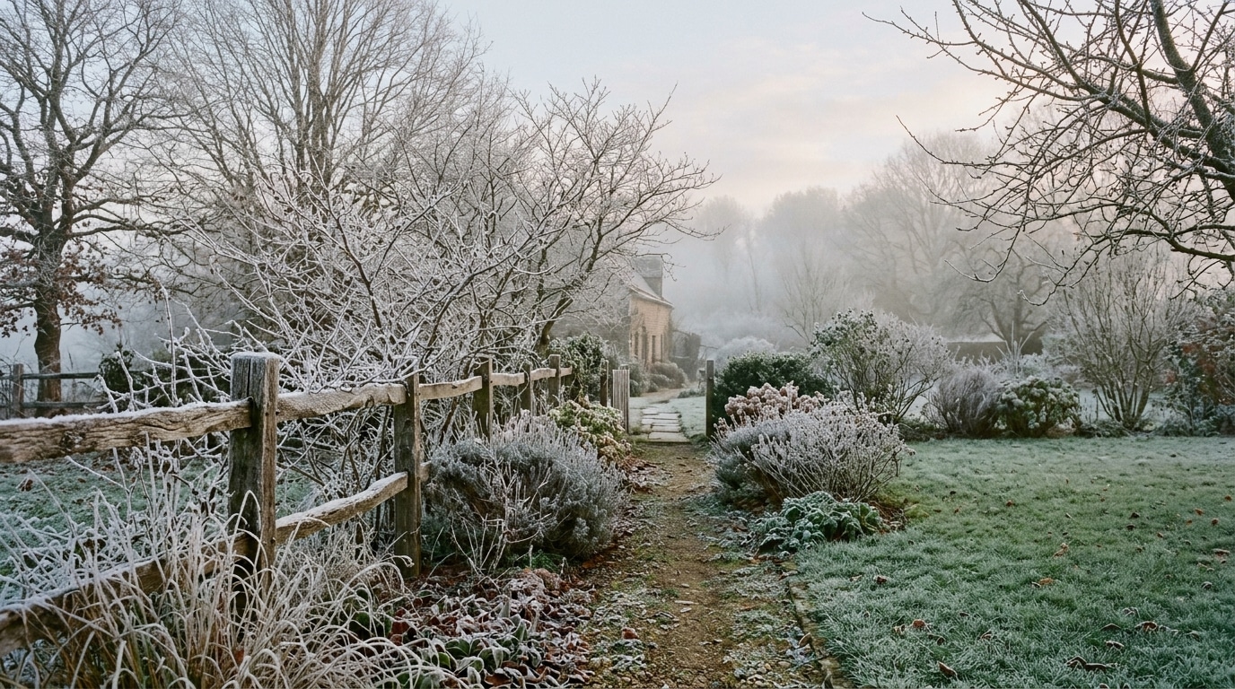
A garden entirely white on a November morning, even though not a single flake had fallen during the night: that’s the kind of scene that leaves people puzzled. Yet this phenomenon is real, and it could affect a large portion of the country in the days ahead. According to Météo-France’s bulletin dated October 25, the week of November 2–8 is expected to bring temperatures and precipitation that are potentially slightly below normal. The European ECMWF model goes even further, placing France 1 to 3 °C below seasonal norms, a cool spell that would also reach a good part of central and eastern Europe. The cause is an easterly to northeasterly continental flow that could pull cold air from Russia toward the west of the continent, with a mass of air dipping below 0 °C down to about 1,500 metres in altitude from Russia to France. Forecasters are clear, however: this is not a cold wave, merely a dip below seasonal norms. It is precisely in this context, a mix of cool air and persistent fog, that the conditions become ideal for frost to appear without a single snowflake falling.
- The week of November 2–8 is expected to be cooler than normal, with no cold spell, creating favorable conditions for freezing fog
- Supercooled fog freezes instantly on contact with surfaces (vegetation, fences, wires) at 0°C or slightly below, forming frost without snowfall
- Wind enhances frost buildup on exposed surfaces, and this dense fog presents a road hazard to monitor via Météo-France vigilance
- The supercooled fog, this deceptive phenomenon
- How ice forms on branches and fences without a single snowflake
- When the wind joins in, frost accumulates and redraws the landscape
The supercooled fog, a phenomenon that deceives appearances
The secret behind this misleading weather lies in one word: supercooled fog. Droplets in fog can remain liquid even when their temperature is already below freezing. They only need a surface to instantly turn into ice. With anticyclonic blocking expected until November 9 according to the European model, mornings are likely to be marked by dull skies and persistent low clouds, typical autumn conditions when an anticyclone settles in for a long spell, with daytime highs potentially staying below 10 °C. Météo-France does not forecast any rainy days from October 30 to November 8 in 43 of 46 cities, but fog is expected 7 days out of 10 in Strasbourg. The coldest nights are already identified, with minimum temperatures possibly dropping to 1.6 °C in Limoges on November 3 and down to -1.5 °C in Ussel on November 6. It is precisely in these conditions, dense fog and temperatures near zero or slightly negative, that the scene can change overnight without a single snowflake having fallen.
How ice forms on branches and fences without a snowflake
The mechanism is actually quite simple to grasp. Freezing fog forms when supercooled droplets instantly freeze upon contact with vegetation, fences, or power lines. As soon as a surface sits at a temperature below or just above 0 °C, according to the World Meteorological Organization’s reference definition, the droplets that brush it solidify on the spot and form a ice deposition. This is what we call frost, which belongs to the same family of hydrometeors as dew, white dew, hoarfrost, or even freezing rain. What makes the phenomenon particularly spectacular is that there are three distinct varieties of frost: soft frost, hard frost, and clear frost, and they can appear almost simultaneously, follow one another in the same night, or alternate over a longer period. Result: the same deposit can show very different textures from one branch to the next. However, this type of fog is not merely a pretty spectacle: it represents a real road hazard, added to the usual reduced visibility, on par with freezing precipitation.
When the wind comes into play, frost accumulates and redraws the landscape
Wind completely changes the game. MeteoSwiss describes in particular a granular frost that forms in fog between -2 and -10 °C, with growth favored by wind, a range that nicely illustrates conditions observed in Switzerland without constituting a universal rule for all frost forms. The World Meteorological Organization notes that hard frost can form a thick layer in the direction exposed to the wind. Concretely, this means that fences, branches, or posts facing the airflow can become noticeably whiter and more ice-laden than their sheltered faces. This is a sensitive period to monitor, especially since France’s Vigilance system indeed incorporates the phenomenon of severe cold from November 1 to March 31, with four color levels depending on the severity of the event. Even without an announced cold snap, it’s wise to keep an eye on these bulletins before heading out early in the morning.
In short, one should not be surprised to find a garden whitened even though no snow fell during the night. Between persistent fog, temperatures flirting with zero, and a wind capable of intensifying deposits on exposed surfaces, all the conditions are in place for frost to do the work instead of snowflakes. A fascinating phenomenon to observe, provided you keep in mind the precautions that accompany it, especially on the road in the early morning.
👉 A small gesture for Space Group? Follow us on Google, add us to your favorites and find us on Google News so you don’t miss any discoveries.