
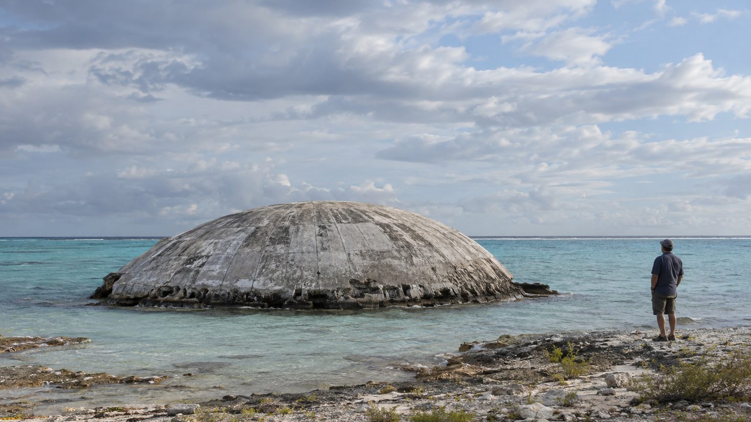
The Runit Dome, located on Enewetak Atoll in the Marshall Islands, is not primarily imperiled by cracks or by earthquakes, but by water. The ocean water that rises and the groundwater that seeps beneath the structure threaten it. According to a 2020 U.S. Department of Energy report to Congress and a 2019 Los Angeles Times investigation, seawater and groundwater intrude under the dome in step with the tides.
The crater floor has never received any lining.
- Seawater and groundwater intrude beneath the Runit dome in step with the tides.
- The 1958 crater received no lining before being filled with contaminated waste.
- Runit rises about 2 meters above sea level.
- Cracks exist on the outer shell, but Washington regards them as a consequence of aging concrete.
A 1958 crater transformed into an atomic waste dump
Between 1946 and 1958, the United States conducted 67 atmospheric and underwater detonations in the Marshall Islands. One of them, Cactus, an 18-kiloton blast in 1958 on Runit Island, roughly 3,700 km west of Hawaii, produced a crater about 9 meters deep and 110 meters in diameter. From 1977 to 1980, the U.S. military deposited soil and debris contaminated by 43 nuclear tests, notably containing plutonium. The volume is estimated at 73,000 m³, roughly equivalent to thirty Olympic swimming pools.
Approximately 4,000 military personnel participated in this three-year operation, and some recall dumping truck beds directly into the crater. The entire structure was capped with a concrete shell 46 cm thick, the height of a chair seat. According to the 2020 report, this outer shell carries no load-bearing function: it only protects the waste pile from natural erosion.
The project was intended as a temporary solution, and to save costs the crater was not lined. The inhabitants of Enewetak, about 150 people displaced to Ujelang Atoll in 1947, returned home in 1980, but Runit remained uninhabited.
A coral sponge beneath 46 centimeters of concrete
The floor of an atoll is coral—a porous material. Seawater and groundwater slip under the dome with the tides, as described by the 2020 Department of Energy report and the 2019 Los Angeles Times investigation. Earlier scientific work has mentioned an open hydraulic connection between the waste and seawater, with migration pathways toward the local groundwater and the lagoon waters. Radionuclides thus percolate into sediments for decades.
Runit rises about 2 meters above the sea.
A study by the Pacific Northwest National Laboratory, submitted to Congress by the Department of Energy in July 2024, identifies storm surge and gradual sea-level rise as the primary factors dispersing radionuclides across the atoll. The 2020 report already suggested that the immediate effect of rising waters would be increased storm surge and wave-driven flooding.
Scientists interviewed by ABC in March 2026 fear that rising waters or more intense storms could eventually degrade the structure and threaten nearby communities. The dome is a mound of concrete set at sea level. The same 2020 report acknowledged that higher sea levels could cause waves to overtop the lower portions of the structure.
Genuine cracks, a risk elsewhere
Cracks indeed run along the outer shell, the ABC News investigation reported in March 2026, while water moves beneath the structure and drags contaminated waste toward the surrounding lagoon. Washington maintains that these cracks correspond to normal aging of the concrete and that the dome is not at risk of collapse in the near term, a conclusion already stated in 2020.
The Department of Energy at the time judged that leaks to the lagoon were not significant compared with other residual contamination sources on the atoll. It acknowledged, however, a lack of data to say how storms would affect the environment. A Marshallese leader lamented that the agency again minimizes risks and refuses to take responsibility for the dome. He also pointed to gaps, including the radioactivity level of the water flowing from the dome into the lagoon.
Communities that rely on the lagoon for food live about thirty kilometers from the dome. The Marshallese government, ABC notes, has very little power to act on the problem.
Drilling to measure what we do not know
Congress requested at the end of 2019, in the 2020 defense bill, a remediation plan and an assessment of the dome’s impact on the lagoon over 20 years. The 2022 law added a study on the effects of climate change, delivered in July 2024. In October 2021, a department official reiterated before a House committee that the dome faced no immediate risk of collapse or failure.
Since May 2013, the department has reestablished monitoring boreholes with the Marshallese, created by former National Academy of Sciences researchers. From 2013 to 2018, several missions collected water samples for radiochemical analyses.
Only a few hundred former workers remain active in the project, according to their association.
Under the PACT Act of 2022, participation in the Enewetak cleanup from 1977 to 1980 is listed among operations with presumed radiological risk for disability claims. Washington, however, disputes the causal link between the cleanup and the illnesses claimed. Regarding the dome, the Department of Energy proposed in 2020 a program of radiochemical analyses of groundwater to measure how storm waves alter the quality of the aquifer.
Sources: researchgate.net | abc.net.au
