
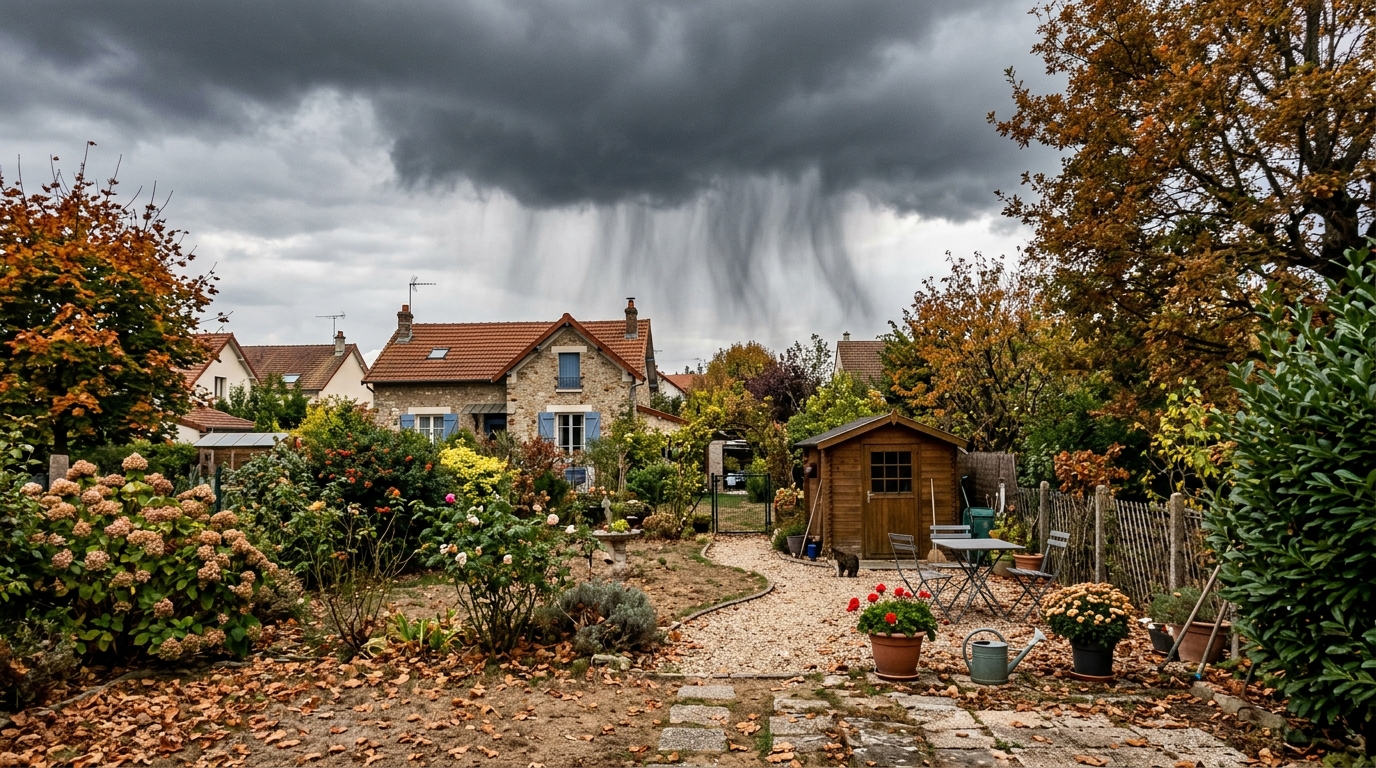
An ice cube melting before it touches the water in the glass: this is what virga looks like. This discreet weather phenomenon intrigues as much as it confounds. You consult the weather radar; precipitation appears above your area, promising imminent rain. Yet outside, the ground remains dry, not a single drop falls. Should we shout forecast error? Not so fast. In this autumn when France swings between dry spells and rainy disturbances, this kind of situation has a real explanation.
- Virga refers to precipitations that evaporate or sublimate before reaching the ground as they pass through a very dry layer of air.
- The radar detects precipitation in the upper atmosphere but cannot predict its evaporation, which explains a mismatch with what is observed on the ground.
- The evaporation of rain can cool the surrounding air and trigger a dry downburst, i.e., sudden gusts of wind without surface precipitation.
- The rain that evaporates before touching the ground: understanding virga
- Why your radar lies (a little) about what actually falls
- Recognizing virga and anticipating its effects on the ground
The rain that evaporates before touching the ground: understanding virga
Virga denotes precipitation that never reaches the ground, regardless of its type. The mechanism is simple to grasp: a cloud releases droplets or crystals, but these pass through a very dry layer of air on the way down. Under this effect, the water evaporates if it is liquid, or sublimes if it is solid. In some cases, this loss is total, so that nothing ever reaches the surface. This phenomenon has no direct impact on the ground, but it can still trigger the formation of new clouds between the original cloud and the ground, a visual effect sometimes surprising. In stormy periods, virga becomes more complicated: under a storm or heavy shower, it can cause low-level turbulence, or even sudden descending gusts. This phenomenon is especially common in arid regions or when the humidity in the lower atmosphere is low, a configuration to watch as autumn 2026 alternates between dry spells and rainy disturbances.
Why your radar lies (a little) about what actually falls
Here lies the heart of the mystery: weather radar detects precipitation aloft, not what actually reaches the ground. In other words, it spots droplets or crystals still present in the atmosphere, without knowing whether they will evaporate before arriving at you. This is exactly what American meteorologists remind us: although the precipitation never touches the ground, virga can often appear on radar images, giving the misleading impression that a zone is receiving rain when the surface is utterly dry. This mismatch seriously complicates the work of forecasters. Forecasting light precipitation becomes a real challenge, because it evaporates more easily in a dry layer of air. Conversely, heavier rainfall quickly saturates the lower layers and ends up reaching the surface without issue. However, one important point must be kept in mind: virga explains certain differences between the radar image and what you observe, but it does not justify all forecast errors. Other factors can also come into play.
Recognizing virga and anticipating its effects on the ground
With the naked eye, virga is recognizable by trails of rain visible beneath the clouds, which fade progressively before reaching the ground. This spectacle, often aesthetically pleasing, nonetheless deserves special vigilance. Indeed, the evaporation of precipitation cools the surrounding air, which becomes denser and can carry wind downward toward the ground at a rapid pace. This mechanism can generate a dry downburst, i.e., sudden and strong gusts of wind, without any rainfall announced at the surface. This type of phenomenon is particularly worth watching. The vertical structure of the atmosphere plays a key role: a layer of dry, stable air between the cloud and ground favors evaporation, while a more humid environment near the base of the cloud can allow rain to start falling before encountering this drier layer lower down. In practice, if you observe a heavy-looking sky with no actual rain, better to stay alert to unpredictable wind gusts than to a shower that will probably not come.
Virga nicely illustrates the complexity of weather: what happens aloft does not always reflect what happens on the ground. It also reminds us that radar, no matter how precise, remains a tool of interpretation and not an absolute guarantee. The next time the sky looks threatening without a single drop falling, you might recognize this discreet phenomenon, between visual illusion and the necessary vigilance faced with the wind.
