
595,000 emperor penguins. That is the figure satellites returned when scientists finally looked at Antarctica from the sky. Twice what ground expeditions had estimated for decades. A correction of such magnitude should have rocked the scientific community, and that is exactly what it did.
What to note
- Researchers had counted by foot for decades in extreme conditions—and were massively wrong
- Satellite technology detects penguins via their guano traces visible from space
- The actual number exceeds previous estimates, but populations are declining at a pace exceeding the worst forecasts
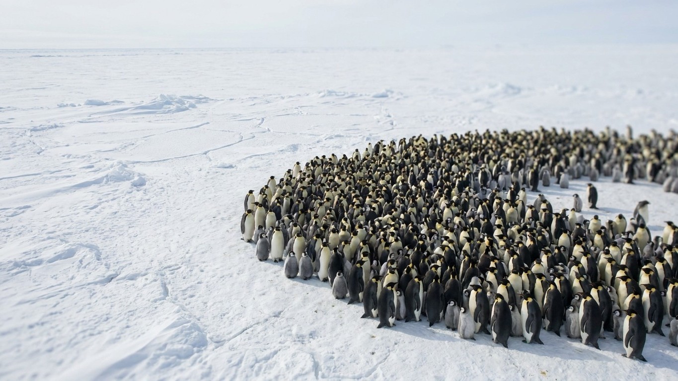
Counting birds at -50 °C from a London desk
For years, tallying emperor penguins was essentially an absurd logistical challenge. Estimating their numbers has always been a particularly delicate undertaking: they breed in remote, inaccessible regions where temperatures can drop to -50°C. Practically, researchers had only a few months each year to work on the continent, and even then only at sites reachable by the researchers. The last global population estimate, made in 1992, concluded 135,000 to 175,000 breeding pairs. That figure was compiled from disparate reports, sometimes decades old, often based on observations made late in the breeding season, i.e., after eggs and chicks had already disappeared.
It was in 2009, almost by chance, that Peter Fretwell, a geographer with the British Antarctic Survey, discovered that emperor penguins could be detected thanks to satellite imagery. The starting idea had an almost childlike elegance: identifying colonies from space mainly hinges on visually spotting the brown stains produced by guano. Bird droppings, visible from low Earth orbit, revealing the presence of thousands of individuals. They were looking for penguins, and they found their traces.
The team surveyed the entire Antarctic coastline using a blend of medium-resolution and very high-resolution satellite images, then analyzed the 2009 breeding-season photographs using a supervised classification method to distinguish penguins from snow, shadows, and guano. Technically, the problem was thorny: an individual occupies no more than a single pixel. They had to craft a filter to distinguish the bird, with its black-and-white plumage, from the snowy background, its shadow, and its droppings. The image resolution was artificially sharpened using a pan-sharpening technique, then calibrated with ground counts at eleven sites.
595,000 individuals: the figure that changed everything
“It surprised us to have roughly doubled the population estimate,” said Peter Fretwell, lead author of the study published in PLoS One. About 280,000 breeding pairs were counted, far higher than previous estimates (135,000 to 175,000). Taking into account the ratio between breeders and non-breeders, the total population is now estimated at 595,000 individuals, well beyond the 270,000 to 350,000 individuals of prior estimates.
The jump is spectacular. Going from 270,000 to 595,000 is like the population of Lyon suddenly materializing in the Antarctic ice, individuals that have always been there, simply invisible from the ground. The analysis not only doubled the previous estimate, but also uncovered seven colonies previously unknown. The largest colony, near Coulman Island in the Ross Sea, would number 25,298 pairs, followed by the Halley Bay colony in the Weddell Sea with 22,510 pairs.
This counting is unprecedented: it is indeed the first time a species has been enumerated from space. The method opens up prospects far beyond penguins. The research is conducted safely, in a reproducible manner, and with no environmental impact. It can be used for other species and across very large territories. Due to its low cost, satellite counting should be able to be carried out at regular intervals to analyze population trends and measure the impact of climate change.
A piece of good news that takes a turn
595,000 penguins is reassuring, until you look at what has followed. Two major studies published in 2025 underpinned the recent status change for the species. The first, by Peter Fretwell and colleagues at the British Antarctic Survey, published in Communications Earth & Environment, analyzed very high-resolution satellite imagery covering 2009–2024 in the Weddell Sea/Bellingshausen Sea sector. The finding: a 22% decline over this period, i.e., about 1.6% per year. This regional decline is more than twice what previous estimates had suggested—and, more importantly, exceeds the most pessimistic projections of population models.
The main cause is the early breakup and loss of sea ice, which has reached record lows since 2016. Emperor penguins depend on “fast ice,” attached to the shore, to the seabed, or to icebergs—as habitat for their chicks and during their molt, a period when they are not waterproof. If the ice breaks up too early, the consequences can be deadly. Before 2022, more than 100 penguin groups had been identified along a stretch of Marie Byrd Land’s coast; by 2025, only 25 small groups remained visible in the satellite images.
The emperor penguin has just changed status on the IUCN Red List. By April 2026, the IUCN classified the emperor penguin among endangered species, notably due to climate change. In the gloomiest scenarios, researchers project a 99% decline in the population by 2100: if nothing changes, the emperor penguin could nearly disappear before the end of the century.
The true lesson of this story isn’t that satellites revealed we had twice as many penguins as we thought. It’s that for decades, our ground-based counting methods gave us a systematically false picture of a species we believed we knew. The emperor penguin is an indicator: if this species collapses in an environment free of direct human pressure, it signals that the global climate system itself is faltering. And the same technology that disclosed their real abundance today documents, colony by colony, their accelerating disappearance.
Sources: jhm-blogs.fr | dailygeekshow.com
