
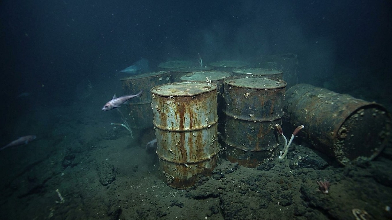
For decades, the official assumption was distilled into a single sentence: drums dumped off the Los Angeles coast would eventually dissolve, their contents dispersing into the vast Pacific. In 2021, a sonar campaign conducted by the Scripps Institution of Oceanography shattered this comforting theory. More than 27,000 objects confidently identified as drums still lie on the seabed in the Santa Monica Basin, at a depth of 900 meters, surrounded by more than 100,000 other industrial debris items in total.
Key takeaways
- A comforting hypothesis collapses under acoustic evidence
- Sonar reveals far more than scientists anticipated
- A supposedly vanished poison has fed the marine food chain for decades
The Failed Ocean Dilution Bet
Between 1947 and 1961, Montrose Chemical, then the world’s largest producer of DDT, disposed of its manufacturing residues off Santa Catalina Island. The logic of the era, now chillingly naive, rested on a conviction shared by the chemical industry: dumped into a sufficiently large body of water, the poison would eventually dissipate without consequence. The popular assumption at the time was that the pesticide would be diluted and dispersed in the water. That proved not to be the case. An investigation by the Los Angeles Times led to the discovery of the shipping records kept by the waste-disposal contractor. These documents show that 2,000 drums of DDT-laden sludge could have been discharged each month between 1947 and 1961 at a designated disposal site. Based on those same archives, some estimates even suggest as many as half a million drums might rest on the seafloor.
Before the large mapping effort of 2021, the site’s reality was known only through sporadic observations. In 2011 and again in 2013, a professor at UC Santa Barbara detected substantial DDT concentrations in sediments in the same area, and cameras captured footage showing as many as 60 drums leaking on the site. Sixty drums found incidentally on dive trips, compared with tens of thousands revealed a few years later—the gap illustrates how much more remained to be discovered beneath the surface.
What the Sonar Really Reveals
The 2021 expedition deployed the research vessel Sally Ride and two autonomous underwater vehicles, REMUS 6000 and Bluefin, equipped with side-scan sonar. The campaign by the Scripps Institution of Oceanography at UC San Diego mapped more than 36,000 acres of seafloor between Santa Catalina Island and the Los Angeles coast, a region already known for elevated DDT levels in sediments and in the ecosystem. In more tangible terms: an area of roughly 145 square kilometers, about the size of the city of San Francisco.
Technically, the feat hinges on the precision of detection. The robots adjust their paths to terrain variations, maintaining a constant altitude of 20 meters above the seabed, using a high-frequency side-scan sonar that sends signals up to 150 meters to either side of the vehicle. The ongoing echolocation of these signals reflected by the seafloor creates images of the relief and of the objects residing there. The result of this systematic sweep: more than 27,000 targets identified with a high level of confidence as drums, and an excess of 100,000 debris objects in total on the seabed.
The figure surprised even the researchers themselves. “It was really a surprise for everyone who worked on the data and sailed at sea,” said Eric Terrill, chief scientist of the expedition and director of the Marine Physical Laboratory at Scripps. Yet there remains a major caveat: the sonar identifies shapes and acoustic signatures consistent with drums, but it will be up to others to confirm through sediment sampling that these containers actually contain DDT. A rusted drum may resemble a rusted drum without knowing, absent chemical analysis, what it originally contained or whether anything remains inside.
Drums That Have Been Leaking for Decades
What we can say with certainty is that the poison continues to circulate through the marine food chain. Scientists also detect elevated DDT levels in marine mammals, including dolphins and sea lions, with exposure to DDT and PCBs linked to the development of cancers in sea lions. Far from being a inert remnant, the deposit functions as a diffuse and enduring source of contamination—half a century after the pesticide was banned in the United States in 1972.
The scale of the site moreover far exceeds the area officially mapped in 2021. Scripps teams had to stop not for lack of debris to document, but due to mission-time constraints: although 46 square miles may seem a substantial surface to cover—and they are—the San Pedro Basin holds much more area to explore, and the crew ran out of funded time to operate the ship, not because there were no debris left to find. The 2021 map is almost certainly only a fraction of the actual disaster.
In response to the scale of the discovery, local officials moved quickly. Los Angeles County Supervisor Janice Hahn called the situation alarming, noting that DDT is “notorious for harming wildlife, including raptors, eagles and fish,” and urged the Environmental Protection Agency to accelerate an assessment of the site. Five years after this mapping, no large-scale removal operation of the drums has been undertaken: the depth of the site, 900 meters, makes mechanical intervention complex and expensive, and scientists are currently prioritizing sediment and wildlife monitoring over a remediation effort whose practical implementation remains uncertain, and whose potential to disperse more poison is a serious concern.
Sources: scripps.ucsd.edu | patch.com
