
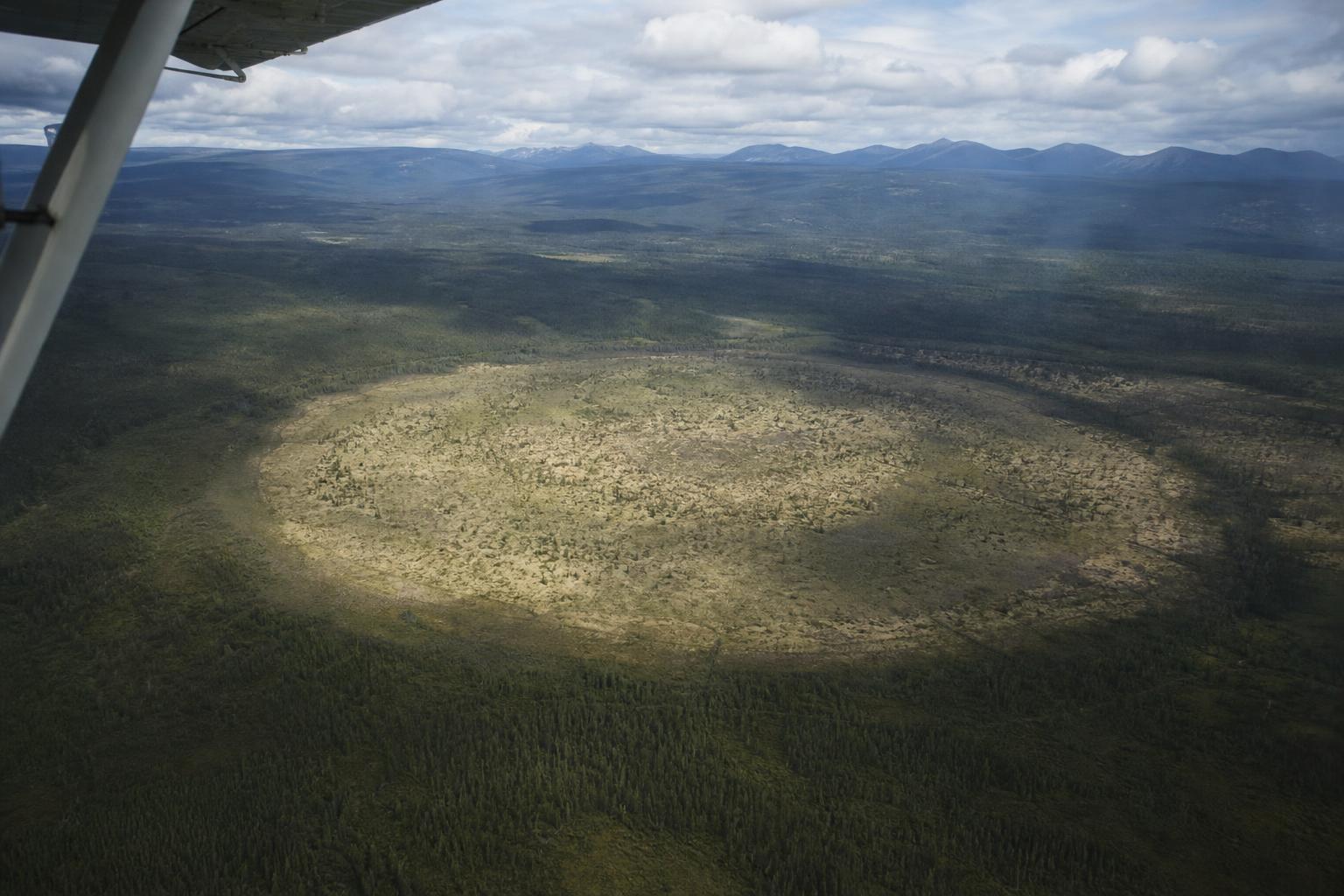
Something uncanny shows up in Alaska’s backcountry: a razor‑clean ring, more than a mile across, etched into a wilderness that usually refuses straight lines. Zoom in on recent satellite tiles and the outline holds—crisp, geometric, and inexplicable. “It looks like someone drew it with a compass,” one observer wrote, “then walked away.” No roads feed it, no towns claim it, and no label on the map will help.
The circle that shouldn’t be there
The feature sits in a swath of tundra and boreal scrub where patterns are normally messy: meandering streams, pocked thaw ponds, and wind‑ruffled muskeg. Against that textural chaos, the ring reads like a glyph—a single, continuous arc that closes almost perfectly on itself. In some light the interior appears subtly toned differently, as though vegetation or soil moisture is not quite the same inside the loop as outside.
Cartographers who haunt open satellite platforms noticed it in a recent imagery refresh and began comparing older passes. The circle seems present in multiple years, but its sharpness varies with season, snow cover, and the angle of sunlight. “It’s less a new thing than a newly seen thing,” one mapper noted.
Nature’s shortlist of suspects
Alaska is a laboratory of circles, and several processes can carve one from nothing:
- Thermokarst lake dynamics that expand and collapse in rounded basins
- Ancient volcanic maars that blast near‑perfect rings when magma meets groundwater
- Ice‑wedge polygons scaling up in odd, composite networks
- Subtle impact scars softened by time and peat
A mile across is large for a pingo or a single thaw pond, but not outlandish for a maar or a drained lakebed. If it were a fresh impact, you’d expect a rim or ejecta apron, and none is obvious at the map’s resolution. A volcanic origin would leave clues—ash lenses, tuff rings, or a magnetic signature—but such evidence needs field boots and instruments.
“Think of it as a geophysical coincidence hiding in plain sight,” says the cautious, composite view among geoscience‑minded onlookers: several small processes aligning to trace one big curve.
Could people have drawn it?
Human hands do make circles, but the setting argues against it. Center‑pivot irrigation paints green disks across farmland, yet there’s no grid of roads or fences here. Military arrays sometimes favor rings, from test tracks to antennas, but known Alaskan installations leave straighter footprints—rectangular pads, berms, and latticework roads. Logging creates pie slices and edges, not perfect roundabouts a mile wide.
If this were an industrial footprint, ancillary clues should pop: containers, shadows of towers, switchbacks, or vehicle scars at the perimeter. So far, the ring looks lonely, with only the land itself to draw the line and hold the shape.
Why circles keep happening in wild places
Circles are nature’s cheapest way to balance forces. Pressure radiates uniformly in wet permafrost; cracking seeks shortest paths; erosion nibbles at edges until curvature evens out the stress. Where groundwater wells up through sediment, rims grow along the zone of equal pressure. Where fire burns under steady wind, smoke plumes arc and embers trace rough loops. Seen from above, many messy events average into startling geometry.
“It’s the bird’s‑eye illusion,” as one geologist likes to say: coarse pixels erase the noise, leaving only the shape our brains latch on to as proof of design or intention.
What we actually know so far
Strip away the poetry and a few firm points remain:
- The ring is visible on multiple dates across public satellite imagery
- No obvious buildings, roads, or utilities connect to the site
- The boundary coincides with subtle changes in surface tone or vegetation texture
- There’s no confirmed scientific or governmental explanation yet
How to ground‑truth a mystery
If curiosity bites, a sensible path forward exists. First, stack imagery across seasons in platforms like Sentinel Hub or Google Earth Engine to watch how the ring breathes—snow on, snow off, wet spring, dry fall. Second, check historic USGS quads, geologic maps, and borehole records for hints of volcanic tuff, peat thickness, or permafrost boundaries. Third, scan SAR datasets, which see through clouds and can highlight moisture and surface roughness. Finally, if access and permits allow, field teams can walk the edge, collect soils, and run handheld magnetics or GPR to sniff for buried structure.
“Extraordinary shapes don’t always demand extraordinary causes,” one field guide likes to remind students. Sometimes the land whispers its design in slow accidents that only satellites can hear.
Waiting for an answer in the thaw
Alaska’s modern climate is loosening the stitches of frozen ground, reorganizing water, gas, and sediment across wide flats. Features that were faint ten years ago may harden into contrast; others will blur as shrubs march and moss thickens. The ring may sharpen, fade, or break—each outcome a clue. Until someone laces up boots and writes the baseline, the mystery holds: a clean circle in a messy world, patient as the tundra, and perfectly content to keep its quiet edge.