
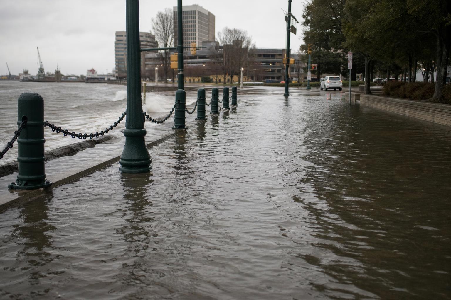
Water threads through daily life in this coastal city, turning high tides into small tests of resilience and making rainstorms feel like roll calls. What seems like simple floodwater is actually the meeting point of two big forces: rising oceans and sinking ground. Together, they’re reshaping streets, homes, and plans for the next decade.
The ground is not just low; it’s lowering. Long after the last ice sheets vanished, the land here is still settling, quietly and relentlessly. “The land is moving as much as the water,” locals say, and the numbers back them up.
Why the land is sinking
During the last ice age, a continent-sized ice sheet pressed the crust downward near Canada while bulging the edges—including parts of today’s Mid-Atlantic—slightly upward. As the ice melted, that bulge began to collapse, a slow-motion rebound called glacial isostatic adjustment. In coastal Virginia, the forebulge is still slumping, a geological echo you can measure.
That background sag is compounded by human history. Decades of regional groundwater pumping compacted deep aquifers, adding a human-made tilt to the natural subsidence. Even as pumping has been curbed, some compaction can persist, the way a pressed sponge never fully regains its shape.
Put simply, the ground is moving down while the ocean moves up, and the combination is more than the sum of its parts. Scientists call this “relative sea-level rise,” and it’s the number that neighborhoods feel on their streets.
A hotspot on the Atlantic seaboard
Tide gauges in the region tell a clear story. Over the last century, water levels have climbed roughly five millimeters per year, with an uptick in the past few decades. That rate sits near the top for the Atlantic coast of the United States, sharpened by local subsidence and shifts in large-scale currents.
Ocean dynamics add their own texture. A wobbling Gulf Stream, wind patterns, and regional warming can make waters “pile up” along the Mid-Atlantic. When those dynamics line up with astronomical tides and a soaking storm, even a modest surge becomes a street-level event.
“Nuisance flooding” has become an everyday phrase, but the nuisance is now a system. High-tide flooding that once happened a few days per year can hit dozens of days per year, disrupting work, school, and simple trips to the store.
Daily life at the waterline
Walk a low-lying block after a strong tide and you’ll see what planners call “sunny-day flooding.” Water seeps from storm drains, curls around curbs, and lingers on asphalt baked by the sun. On windless days, you can hear “the sea in the sewers,” as one resident likes to say.
The impacts stack up in quiet ways. Insurance grows costly, mortgages get tricky, and repairs become part of a household budget. Navy operations, port traffic, and shipyard work must thread schedules through storms and king tides.
Yet the city has cultivated a habit of adaptation. Residents keep spare boots by the door, mark curb heights with mental maps, and check tides the way other places check traffic.
Engineering the future higher
Adaptation here is not a single project but a layered strategy. Planners mix gray infrastructure with green buffers, and they test small pilots before scaling up the big stuff. “Water is patient,” an engineer said at a recent meeting, “so our designs must be persistent.”
A typical toolkit now includes:
- Elevated roads, higher curbs, and floodable parks that double as overflow bowls
- Tide gates, pump stations, and regraded inlets to steer and store surges
- “Living shorelines” made of oyster reefs, marsh plantings, and low rock sills
- Home elevations, floodproof retrofits, and buyouts in the most vulnerable spots
- Data-rich maps, real-time sensors, and neighborhood-level flood alerts
Federal and local partners are advancing major defenses, from seawalls with navigable gates to distributed barriers that protect critical corridors. The U.S. military’s footprint adds urgency and funding, but also demands designs that keep ports open and bases ready.
The science locals can feel
None of this erases the basic physics. Warmer oceans expand, land continues to settle, and storms ride on a higher baseline. Every extra inch of water raises the odds that everyday tides find their way into yards and across intersections.
Still, there’s room for agency. Emissions cuts change the late-century path, shaving inches—and sometimes feet—off projections. Zoning that respects the floodplain, building codes that reward elevation, and investments that favor nature-based buffers can stretch precious time.
People here often put it simply: “We can live with water, but we can’t live with surprise.” Clear signals, steady funding, and long-term maintenance turn adaptation from a headline into a habit.
What comes next
This coast is a living laboratory, where geology meets infrastructure in real time. The same forces that pressed and lifted the crust thousands of years ago are still part of today’s city budget. That perspective can feel sobering, but it can also sharpen focus.
The path forward is not about a single, towering wall, but a thousand coordinated choices—where to build, what to raise, how to store water, and when to let it flow. In a place shaped by long memory and quick tides, the wisest tools are the ones that respect both history and physics.