
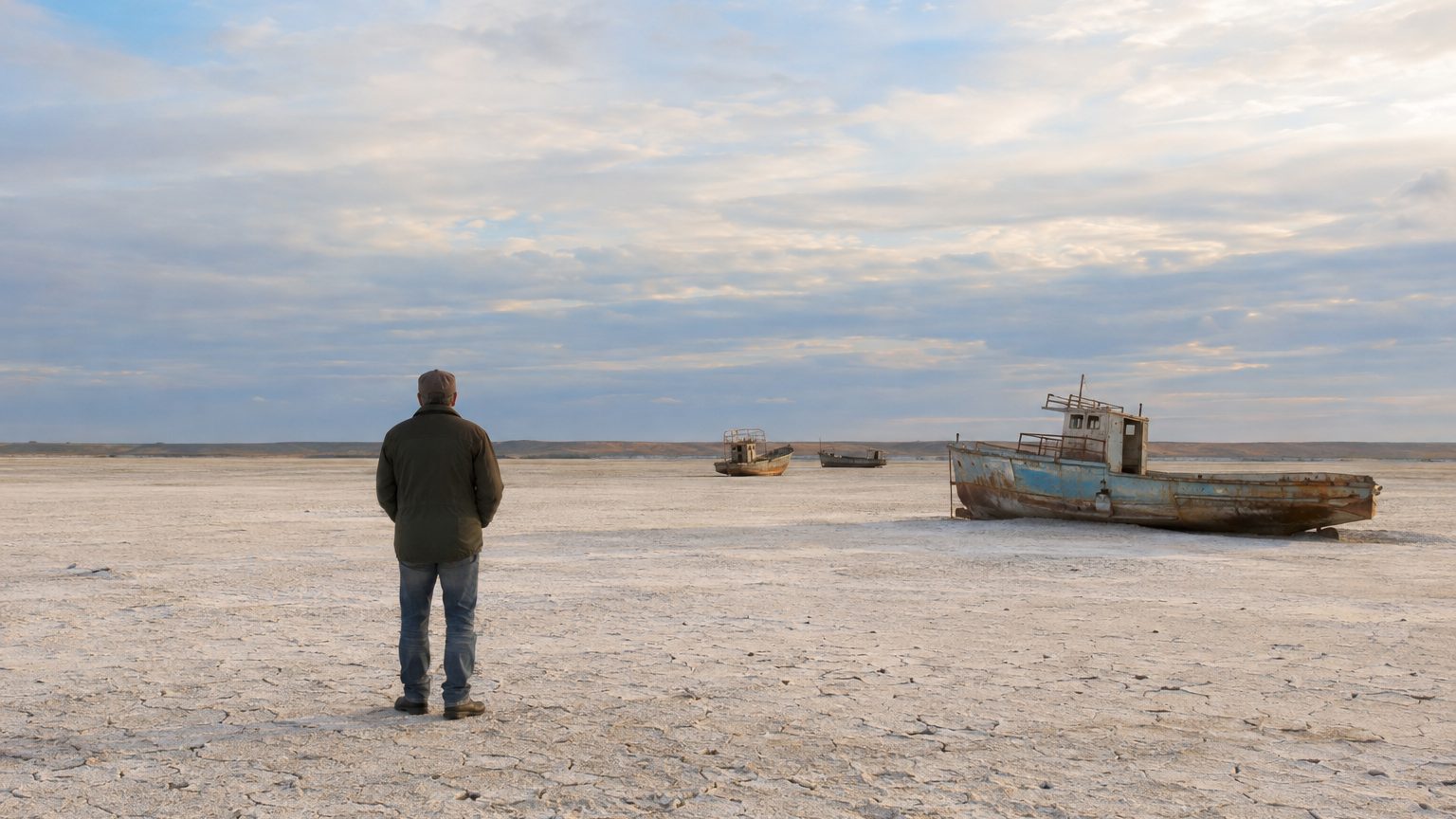
Between Kazakhstan and Uzbekistan, where fishermen and freighters once sailed the Aral Sea, there stretches today a pale, sterile steppe. Its name: the Aralkum. Covering about 27,000 km², roughly the size of Brittany, former seabed sediments dried into a desert of salt-bearing sediments that agriculture never colonized.
Everything began with a decision made in 1960.
That year, the USSR diverted the Amu Darya and the Syr Darya, two major rivers of Central Asia, to irrigate cotton fields. They had until then fed the Aral Sea, which was then the fourth largest inland body of water on the planet. According to CNES, they themselves are nourished by the high mountains of the Himalayan system. Deprived of these inflows, the sea gradually withered, then fractured.
- The Aralkum covers about 27,000 km² of salty sediments in Kazakhstan and Uzbekistan.
- The Aral Sea lost 90% of its surface since 1960.
- The diversion of the Amu Darya and Syr Darya for cotton irrigation is the cause of the drying.
- Salted dust storms carry these sediments over thousands of kilometers.
Sixty Years of Retreat, 90% of Surface Lost
The figures from CNES measure the retreat. The Aral Sea covered 66,460 km² in 1960, roughly twice the size of Belgium, and today only 7,300 km² remain.
That represents a 90% reduction in its surface area in six decades. The agency attributes most of the process to the explosive growth of human withdrawals, driven by an unsustainable growth model that wastes water, especially for intensive agriculture. The reference image, captured by the Sentinel-2B satellite on August 19, 2021, shows what remains in natural colors, with a native resolution of 10 meters.
Land areas attributed to the Aralkum vary by source. The most widely cited account holds 27,000 km² of salty desert, but other estimates approach 60,000 km². The discrepancy hinges on whether one includes the desiccated but still moist soils or the margins of the Little Aral as part of the desert. CNES, for its part, notes a loss of about 59,000 km² of water surface between 1960 and today.
The paradox is stark: a project intended to create arable land ended up sterilizing far more, and the seabed itself never supported any cultivation.
A Desert That Agriculture Never Colonized
The soil of the Aralkum is far from ordinary sand.
Under its chalky crust have accumulated, over decades, marine salts concentrated and residues of pesticides carried by the rivers from cotton fields. Other syntheses add fertilizers and defoliants spread upstream. Nothing thrives here, which explains why attempts at fixation rely on planting saxaul shrubs—those hardy shrubs capable of surviving in extreme conditions—rather than crops.
Before the catastrophe, the Aral Sea was a closed sea, comparable to the Caspian, with an area around 67,000 km², slightly smaller than Ireland. It formed a vast oasis in the middle of the desert. Ports like Aralsk, in the northeast, saw the water recede from their quays.
Dust Storms That Do Not Stay Put
The wind does the rest. The dried bottom has become a powerful source of wind-driven salty dust emissions. Estimates range from 43 million tonnes per year, a figure put forward by a recent analysis of sediments and agricultural residues, to 100–150 million tonnes according to other calculations, reported by a NASA Goddard Space Flight Center researcher. Such a range mainly reflects the difficulty of measuring a diffuse phenomenon spread across thousands of square kilometers.
These dust storms affect regions thousands of kilometers away, according to scientists quoted by the original article. A study involving the Leibniz Institute for Troposphere Research (TROPOS), picked up by the press, links these dusts to climate and distant glaciers. Some syntheses mention deposits reaching the Himalayas, Scandinavia, or the Arctic, though not all trajectories are documented in the same way.
The desert continues to expand a little further south every summer.
The Little Aral, Brightened to the North
In south-central Kazakhstan, the Little Sea of Aral endures as a residual system of the former sea. Not deep, it comprises three annexes being singled out, notably Butakov and Shevchenko, according to CNES. Aralsk, a small town in the northeast, was once a major port.
A partial revival has been observed since 2005, after the construction of the Kok-Aral dam. Satellites Topex/Poseidon, Jason-1 and ERS continuously tracked the sea level, which helped enhance understanding of the water cycle and contributed to the rescue plan, according to CNES’s video library. Fishing is said to have resumed as early as 2006. In the south, however, the situation remains critical and the eastern basin is nearly dry.
The CNES remains cautious: some investments in local infrastructure aim to slow desertification, but no structural reversal seems to emerge despite media-driven projects. On the living side, a synthesis citing the scientific community lists 28 endemic species that have disappeared from the Aral Sea.
Sources: le-bouillon-larochelle.fr | keops-ingenierie.fr | odysseedelaterre.fr
