
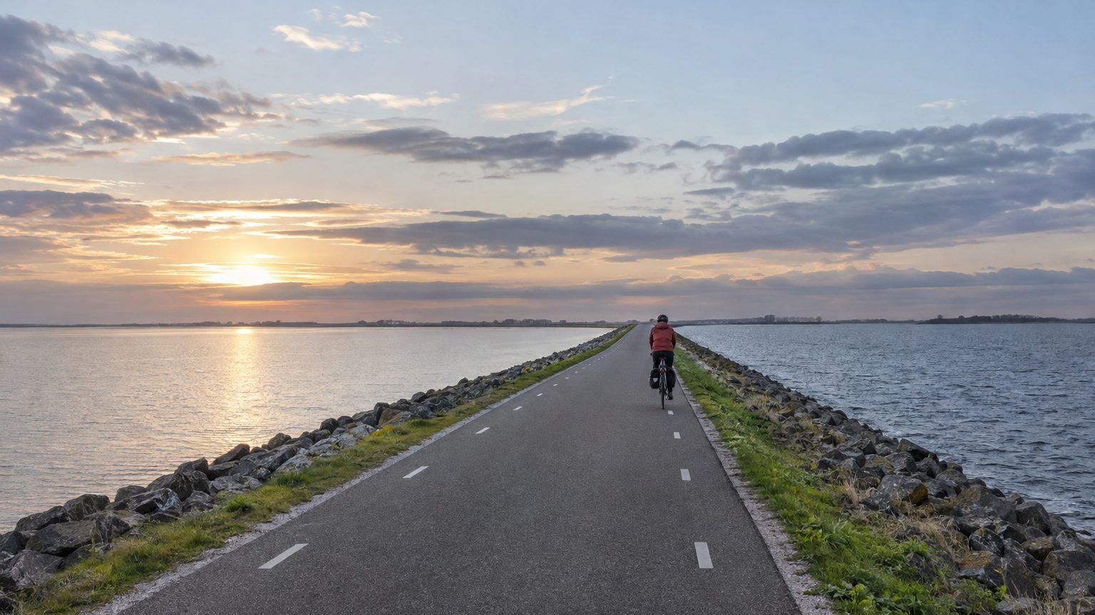
The A7 runs straight for 32 kilometers, with the Wadden Sea on one side and a lake on the other. The asphalt ribbon skirts the crest of the Afsluitdijk, the “closing dike” that links North Holland to Friesland. At 100 km/h, the crossing takes under 20 minutes, separating saltwater on one side from freshwater on the other.
- The Afsluitdijk was completed in 1932 and stretches for 32 km.
- The Zuiderzee, cut off from the North Sea, became the IJsselmeer, a freshwater lake.
- The dike interrupted the migratory routes of many fish species.
A Flood in 1916, a Dike Built by Hand
It all begins with a catastrophe, in 1916.
That year, a devastating flood struck the Zuiderzee’s shores, a seawater inlet that opened largely to the North Sea. A large portion of the Netherlands lies below sea level, and storms there have long inspired fear. The Dutch government decides to build a dike between the Zuiderzee and the North Sea, and construction starts in 1927. The coastline to defend shifts from more than 300 kilometers of vulnerable shore to 32 kilometers of dike.
Rijkswaterstaat, the Dutch public authority responsible for major waterworks, describes a dike largely constructed by hand and completed in 1932. Thousands of arms laid the stones one by one along a route drawn by Cornelis Lely.
The last tidal channel, the Vlieter, is closed in May 1932, two years ahead of schedule. The sea arm is severed from the North Sea, and the two provinces are linked by road.
From Saltwater to the IJsselmeer in a Few Years
Cut off from the North Sea, the Zuiderzee becomes the IJsselmeer, the “IJssel Lake,” named after the river that flows into it. The freshwater that continues to arrive gradually pushes out the salt within a few years, and the former sea arm today stands as the largest lake in the Netherlands.
On the other side of the A7, the Wadden Sea remains saline.
Part of the former Zuiderzee was subsequently drained into polders, while another portion was isolated to form the Markermeer. Tens of thousands of people use the dike daily, with the UNESCO-listed Wadden Sea on one side and the IJsselmeer on the other. More than 600,000 visitors stop by each year, making it one of the country’s most frequented hydraulic works.
The Effect No One Had Quantified
The plans prioritized residents’ safety and land reclamation from the water. No one had estimated the cost to the fish: the dike cut off migratory routes for about a hundred species. In the Netherlands, people often say Lely had anticipated everything except the fish.
Some fish shuttle between the salty Wadden Sea and the freshwater IJsselmeer, because they spawn in fresh water and rear their offspring there. The dike disrupts this cycle. The gates at Den Oever and Kornwerderzand discharge floodwater from the lake toward the sea. Millions of fish swarm near the Wadden Sea by these gates, drawn by the fresh water they sense seeping through.
Some species, such as the Zuiderzee herring, even disappeared.
In 2018, a Wadden Sea conservation group estimated a 90% decline in fish stocks compared with 1959. The dike probably isn’t the sole cause, but it did close the door to species that depended on passage between the two waters.
Strengthening the Dike Without Forgetting the Fish
After nearly 90 years of service, the dike no longer met contemporary standards and bore the full impact of climate change. On the Wadden Sea side, it was raised by about 2 meters. Concrete blocks weighing 6,500 kg each — roughly the weight of an African elephant — were laid atop the basalt blocks at the base of the embankment to break the waves.
Dozens of thousands of these blocks were installed, each equipped with a GPS chip to ease inspection. Specifically designed for this dike, they were tested on scale models in wave channels. Work on the roadway began in 2019 and finished in 2023. The remaining task was draining the lake: in Den Oever, new gates and a pumping station allow greater discharge of IJsselmeer water toward the Wadden Sea, with “fish-friendly” pumps that consume little and run on solar power produced on the dike.
Inaugurated at the start of October, the station comprises six pumps and boosts the discharge capacity toward the Wadden Sea by 45%. Rising sea levels shorten the windows when water can flow by gravity alone.
On the fish side, a 4-kilometer migration river, developed on the Frisian side, is meant to let them move freely from fresh to saltwater. At Den Oever, a bypass already exists: a flow of freshwater, the same cue that holds fish before the gates, draws them toward the entrance, then a conduit takes them to an acclimation basin before entering the IJsselmeer. Eels, salmon, sprats, and herrings are among the species that already use these facilities.
Sources: plusaunord.com | maritimejournal.com
