
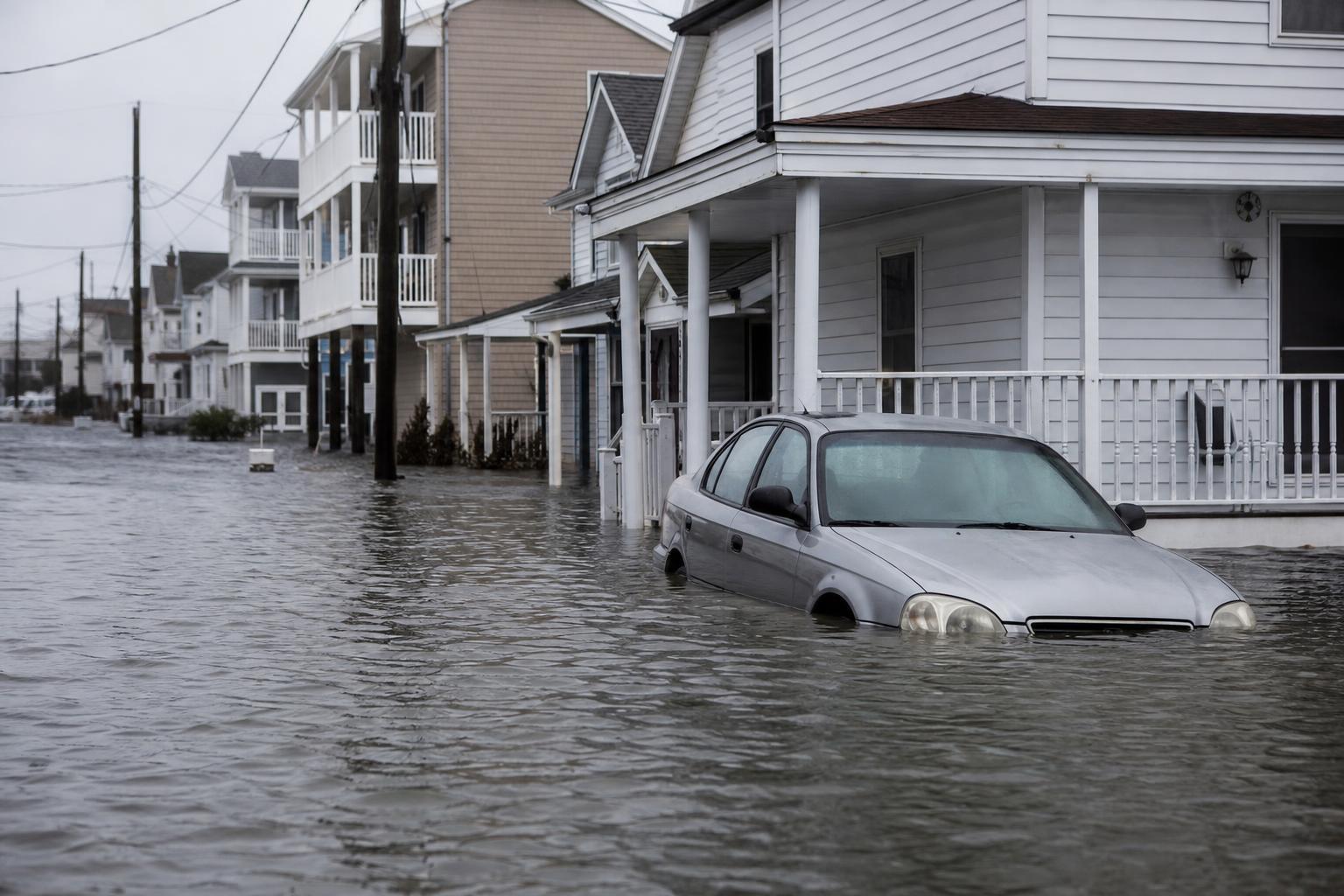
Rising seas are redrawing the American shoreline, and a new study warns the shift could arrive faster than many expect. By late century, stretches of today’s bustling waterfronts may see regular saltwater on streets, yards, and infrastructure—not just during hurricanes, but on otherwise calm days. “We are not talking about rare storms,” one researcher said. “We are talking about the tide itself.”
The pace of encroachment will vary by region, but the direction is clear. Under higher warming and continued subsidence, parts of low-lying neighborhoods could face chronic inundation within decades, escalating to near-permanent flooding before 2100 in worst-case scenarios. “How far and how fast it goes depends on choices we make now,” the authors add.
What the new projections suggest
The analysis maps where water will regularly exceed local elevations as seas rise and land sinks. It flags “chronic flooding” thresholds—streets swamped dozens of days per year—long before total submergence. That distinction matters for planning, because a place can be “functionally underwater” even when maps still show land.
“Once flooding becomes routine, services break down,” one coastal engineer noted. Buses get rerouted, septic systems fail, and businesses face closures that ripple through the economy. It is not a single catastrophe, but a slow accumulation of unworkable days.
Why the water keeps rising
Three drivers converge along the coast. First, warming oceans expand, raising the global baseline. Second, land ice from Greenland and Antarctica melts, adding fresh volume. Third, local subsidence lowers the ground relative to the sea—a major issue in the Gulf and mid-Atlantic.
On the East Coast, ocean currents also play a role. A slowing Gulf Stream can nudge water levels higher, stacking seas against the shore. In deltaic regions, sediment compaction and historical groundwater pumping worsen the drop. “It’s sea level on a moving platform,” a geologist said.
U.S. hotspots most at risk
Several cities face overlapping pressures—low elevation, rapid development, and critical assets right at the edge. The study highlights the following areas:
- Miami–Miami Beach, Florida: Porous limestone means seawalls leak; chronic king-tide floods spread inland.
- New Orleans, Louisiana: Intense subsidence and storm surge exposure threaten levee-protected basins.
- Norfolk–Virginia Beach, Virginia: Regional land sinking and tidal amplification drive frequent high-tide flooding.
- Charleston, South Carolina: Historic core at low elevation, with rising nuisance flood days.
- New York City, New York: High-value shoreline, legacy infrastructure, and growing extreme water heights.
- Boston, Massachusetts: Low-lying harbor districts and waterfront redevelopment in the firing line.
- Houston–Galveston, Texas: Energy corridor, subsidence, and storm exposure on a widening front.
- San Francisco Bay Area: Airports, tech campuses, and bayfront communities at risk, especially during king tides.
People, property, and the equity gap
Behind the maps are families, mortgages, and memories. As floods increase, insurance costs rise, lenders grow cautious, and markets begin to shift. “We’re already seeing pressure in certain zip codes,” one housing analyst said.
The burden won’t fall evenly. Lower-income residents and communities of color often occupy the most vulnerable parcels, with fewer resources to elevate, retrofit, or relocate. Without careful policy, adaptation can trigger displacement or climate gentrification, moving risk rather than reducing it.
What adaptation can do—and can’t
Cities are experimenting with seawalls, surge barriers, and pump systems, alongside living shorelines, oyster reefs, and wetlands that absorb waves. Zoning changes, home elevations, and buyout programs are growing tools in the kit.
But no single fix suits every block, and maintenance is perpetual. “Water always finds a way,” a flood manager warned. The most durable strategies blend protect, accommodate, and retreat, matched to local geology, budgets, and community priorities.
Timelines, uncertainty, and agency
Near-term rise—on the order of a foot by midcentury along many U.S. coasts—is widely expected, with local variation. Late-century outcomes diverge more, hinging on emissions, ice-sheet behavior, and vertical land motion. Uncertainty is not a pass; it’s a planning parameter.
“Think in tiers,” the researchers advise: act now for what’s locked in, design for plausible futures, and build options to adjust over time. That means flexible codes, modular defenses, and financial tools that evolve as conditions change.
What to watch next
Key signals include rising nuisance flood days, insurance market shifts, and state-level resilience funding. New elevation data, better land-motion maps, and faster permitting for nature-based projects will shape what gets built—and what does not.
“The coastline our grandparents knew is gone,” one planner reflected. “But the future is not prewritten. Every ton of avoided carbon, every smart land-use decision, buys time, lowers risk, and keeps communities whole.” For coastal cities, that is the essential choice—and the window to make it is now.