
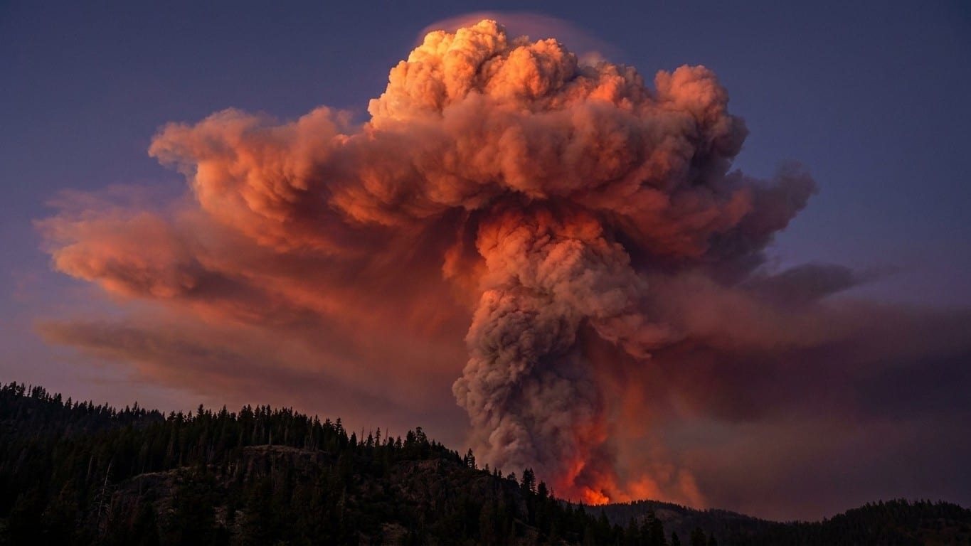
On July 24, 2026, around 6:20 p.m., a plume of smoke turned into a true thunderstorm over the Gironde. “Around 6:20 p.m. this Friday, the fire transformed into a pyrocumulonimbus, a phenomenon never observed in France, a first,” said Marc Vermeulen, director of the Gironde Departmental Fire Service. This fire cloud, capable of generating its own lightning and projecting embers for kilometers, illustrates a problem that operational meteorology still struggles to resolve: predicting a fire that breeds its own atmosphere. In the face of this gap, a handful of researchers are betting on machine learning applied to satellite imagery to spot, up to 24 hours before they appear, the conditions that give birth to these convective monsters.
À retenir
- An algorithm capable of detecting the conditions preceding the formation of a fire cloud before it even exists
- How AI succeeds where traditional meteorology fails in the face of fires that create their own weather
- Pyrocumulonimbus: these extreme phenomena that defy traditional simulation models
When Fire Invents Its Own Weather
The blaze that began near Saumos, in Médoc, is no ordinary fire. The fire ravaging the Arcachon basin since Wednesday has reached a critical threshold: it now creates its own propagation conditions, and firefighters admit they are losing the battle against a convection phenomenon that generates its own destructive winds. Concretely, the heat released by the flames lifts a column of air so powerful that it pulls in surrounding cool air to feed the combustion, somewhat like a giant self-sustaining chimney.
This mechanism changes everything for ground crews. The convective fire tends to generate “its own weather,” including its own wind, and will exhibit “slightly more erratic behaviours and directions,” not necessarily tending to move in the direction of the flow. The prevailing wind forecast by Météo-France tells little about the fire’s actual behavior. And when the convective column reaches a certain altitude, the water vapor it carries condenses into a cloud capable of producing lightning, downdrafts, and embers projected far ahead of the flame front. “This kind of phenomenon is likely to generate lightning upwind of the arrival of this pyrocumulonimbus, but also to trigger ember attacks,” Marc Vermeulen stated the day after the episode.
Pyrocast, the Pipeline that Reads Clouds Before They Appear
That very gap is precisely what Pyrocast aims to fill, a machine-learning pipeline developed notably by researchers at Cambridge University. This pipeline for analyzing and forecasting pyroCb relies on a database that gathers geostationary imagery and environmental data for more than 148 pyroCb events that occurred in North America, Australia, and Russia between 2018 and 2022. The idea: instead of simulating the complex physics of convection, let algorithms identify for themselves the combinations of signals, infrared brightness temperature, plume texture, and altitude humidity that statistically precede the tipping point toward a fire-driven storm.
The results of early versions are solid. Random forests, convolutional neural networks, and CNNs pretrained by autoencoders were tested to predict the generation of a pyroCb for a given fire six hours in advance, and the best model achieved an area under the ROC curve of 0.90 ± 0.04, a score that in machine learning denotes a very reliable discrimination between a fire that will flare up and one that will remain tame. A newer version of the project, published in early 2026, pushes the exercise further: it relies on an inventory of 214 pyroCb events observed in the United States and Canada between 2013 and 2020, with data from 91 events in 2021 used as an independent test set. The authors’ stated objective: expand this framework globally through next-generation geostationary sensors, to enable operational forecasting of pyroCb, with anticipation windows now targeting up to 24 hours in the most favorable scenarios, versus six hours for the initial version.
This is not an isolated case. In the United States, NOAA is pursuing a related track: satellite data already contribute to models that help forecast smoke movement up to 24 hours in advance. In India, a team has even adapted Pyrocast’s architecture to data from the European Meteosat satellite to monitor fires in the region, proof that the method can be exported beyond its North American-origin field.
What This Really Changes for Firefighters
A ROC-AUC score of 0.90 does not yet turn an algorithm into a crystal ball for the incident commander. These models remain probabilistic tools, trained on a few hundred events recorded worldwide, a tiny sample compared to the diversity of terrains, vegetation, and air masses that exist on Earth. A pine forest fire in Landes de Gascogne does not share the same thermal signature as an Australian bushfire or a Canadian boreal blaze, and the researchers themselves acknowledge that pyroCb remains poorly understood on a physical level.
But the practical interest is real. A twelve- to twenty-four-hour early warning would allow repositioning aerial resources before the convective tipping point, prepare preventive evacuations in municipalities under the probable ember trajectory, or simply inform air traffic that a plume capable of breaching the stratosphere is forming. For a massif like the Landes of Gascony, where dry fuel accumulates after consecutive dry summers, such a forecasting window could make the difference between a controlled fire and a blaze that, as in July 2026, exceeds 32,000 hectares in a few days. It remains to be seen whether French rescue services, still under-equipped to integrate these model outputs into their command tools, will turn this statistical advance into operational decisions before the next high-risk summer.
Sources: cnews.fr | france3-regions.franceinfo.fr
