
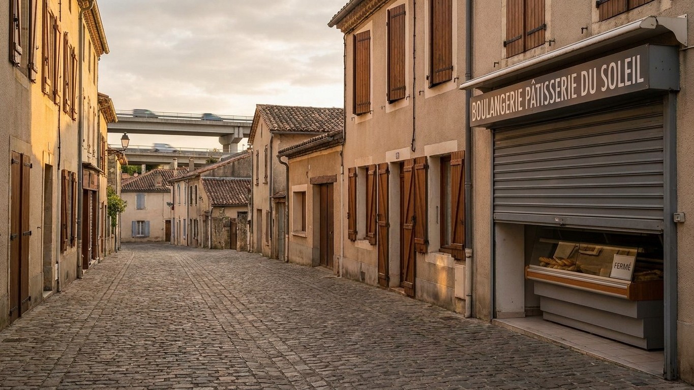
The tunnel effect. That is the name geographers have given to the paradox that has haunted French territorial planning for six decades: a road or a highway intended to connect a village to the rest of the country can, in reality, impoverish it more than it unblocks it. For geographers Camille Tiano and Clara Loïzzo, the tunnel effect designates “the erasure of intermediate relays by the implementation of a rapid means of circulation on an axis, the absence or insufficiency of entry points into the network.” The road makes the journey to the big city so easy that residents have no reason to stop at the local bakery or grocer. Local commerce loses its captive clientele, closes, and the village empties out a little more.
To note
- A road meant to save villages paradoxically accelerated their commercial desertification
- Geographers named this phenomenon the “tunnel effect”: you pass by without ever stopping
- Sixty years of territorial planning policy have not found the magic formula between isolation and depopulation
A State Objective Dating Back More Than Sixty Years
Everything begins in February 1963, when the State creates the Delegation for Territorial Planning and Regional Action. The unequal distribution of activities across the territory, highlighted by Jean-François Gravier in 1947 in his work Paris et le désert français, finds a strong institutional response with the creation of DATAR in 1963, led by its first two delegates, Olivier Guichard and Jérôme Monod, from 1963 to 1974. The mission is clear: to rebalance population distribution, to foster the development of new activity zones, and to equip the country with infrastructure and modern facilities. Road, opening up, territorial equality: the triptych becomes the mantra of several generations of senior officials.
The reasoning seems flawless. A poorly connected village loses its inhabitants, its shops, its public services. Open a road, and the vicious circle reverses. But the reality on the ground ended up refuting this linear logic, and it is precisely there that geographers began to take a close interest in the side effects of these major projects.
When the Road That Was Supposed to Save the Village Emptied It
The tunnel effect denotes the loss of relative accessibility for small hubs when constructing high-speed infrastructure between major poles. Concretely, the more road or rail axes seek to reduce travel time between two metropolises, the fewer intermediate access points they multiply. High-speed lines (LGV) and highways thus have fewer access points than conventional lines and ordinary roads, in the name of performance and profitability.
The most caricatured example is undoubtedly the Haute-Picardie TGV station. Located in the countryside between Amiens and Saint-Quentin, it is nicknamed the beetroot station because its placement seems detached from any local life. Another striking illustration: the A31 highway crossing the Langres plateau offers no public access for 32 kilometers, while seventeen road axes cross it without ever connecting to it. The territory is traversed, but not irrigated. That is the whole nuance of misdesigned opening up: you pass by the village without ever stopping there.
The phenomenon is not limited to national-scale infrastructures. At the scale of a rural town linked more quickly to its sub-prefecture, the mechanism is identical, just more discreet. Residents do their shopping on Saturdays at the supermarket in the neighboring city, rather than at the village shop, now accessible in fifteen minutes instead of forty. Transportation networks thus contribute to contemporary trends of metropolization, leaving aside territories that become victims of this tunnel effect, without any engineer ever marking this box in their impact study.
Shutters Go Down, a Rural France Depopulates
The observation goes far beyond anecdote. The phenomenon of shop and service closures in French rural areas continues today, with a temporal, numerical, and social significance so great that it has become impossible to study rural territories without taking it into account. Bakeries, tobacconists, grocery stores: shutters go down one after another, and each closure accelerates the next by reducing the attractiveness of the town center.
What stands out is the gap between the initial intention of planners and the result on the ground. A road designed to keep the population in place ends up giving them the means to leave more easily, or at least to shop elsewhere. The irony is complete: opening up, envisioned as a bulwark against depopulation, sometimes becomes its accelerator. Senators themselves have begun to question the relevance of the criteria used to measure this famous opening up, deemed too simplistic to reflect the complexity of real territorial dynamics.
Rethinking Planning Rather Than the Mere Connection
In light of this, geographers and planners today advocate for a finer approach. It is no longer enough to measure the travel time to the nearest prefecture; one must also observe what happens once the road opens, anticipate consumer flows, and sometimes accompany the opening of a route with measures to support local commerce, under penalty of seeing the opposite effect occur. Some local authorities have thus begun conditioning their aid on commitments to maintain nearby shops, aware that mere asphalt is not enough to sustain a village.
The opposite also exists, reminding us that the question is never definitively settled. In Cap Sizun, in Finistère, a bridge linking two communes collapsed under the onslaught of winter storms, cutting the road between them for several months. Here, it is not the opening of a route that threatens the shops, but its sudden disappearance, which isolates once again residents accustomed to moving freely. Between the enclavement that isolates and the opening up that drains, geographers have yet to find the magic formula: that of a road that connects without ever forgetting what it passes through.
Sources: enenvor.fr | ahpne.fr
