
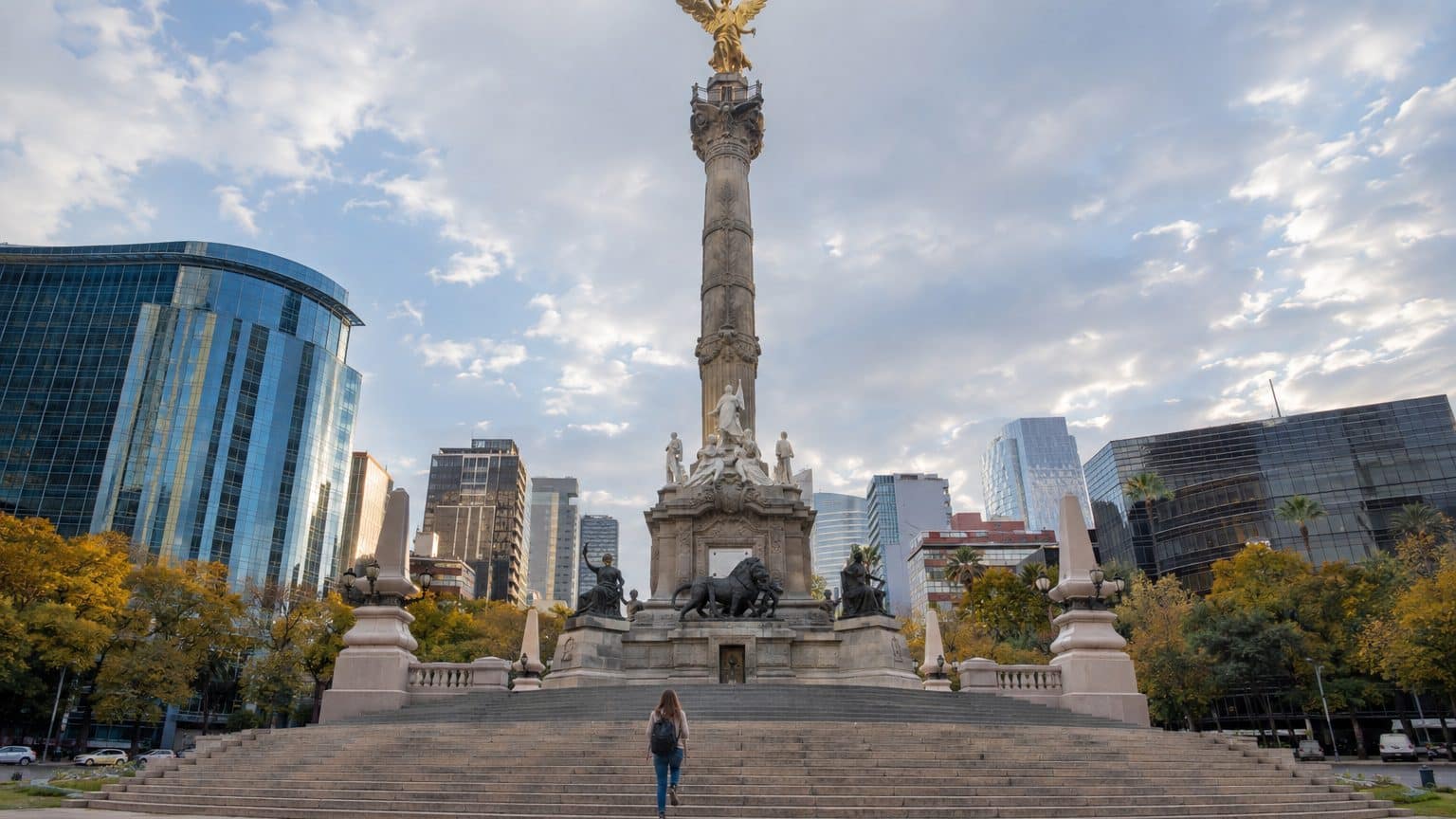
- Fourteen steps have been added to the base of the Angel of Independence to keep it accessible.
- The ground of Mexico City sinks by about 2 cm per month in certain areas.
- Extracting water from the aquifer causes the clay to compact and the city to descend.
A 35‑meter column that stays in place as the street sinks
Fourteen steps. That is what needed to be added at the foot of the Angel of Independence, the 35‑meter-high column inaugurated in 1910 for the centenary of Mexico’s independence, so that it could still be accessed. The reason comes down to a single line: the ground of Mexico City is sinking.
Along Paseo de la Reforma, visitors climb these steps to pose for photographs in front of the golden Angel. At the inauguration, these stairs did not exist, since the monument’s base stood at street level. The staircase lengthened as the terrain sank, and an UNAM geologist describes the logic this way: every so often you add another degree. A photograph from 1910 and a current shot from the same angle, side by side, would reveal the offset without a caption.
The monument remained in place; it was the street that fell.
What satellites see from space
Measuring this movement no longer requires a bubble level. The NISAR satellite, launched in July 2025 by NASA and the Indian Space Agency, recorded between October 2025 and January 2026 subsidence of about 2 cm per month in several areas, including the airport and the base of the Angel. That adds up to more than 24 cm per year, roughly a 30‑centimeter rule of thumb.
NISAR’s radar operates day and night, in clear or cloudy weather, and revisits the same area multiple times per month. By comparing successive passes, the mission detects extremely small ground movements, whether subsidence or uplift. It is the first satellite to carry two radars with different wavelengths. On the maps released for Mexico, the areas sinking the most appear in blue.
More than 12 meters down in less than a century, estimates an UNAM researcher.
Pumping for drinking water, and the clay settles
The culprit is nothing mysterious. Mexico City sits atop the former Tenochtitlan Lake, the Aztec city, and its sprawling metropolis of about 22 million people rests on an aquifer that provides roughly 60% of its drinking water.
The act can be summed up in one verb: pumping. When water leaves the sediments, the clay becomes compacted, and the weight of buildings compounds the settling. UNAM geologists judge the extraction as “irrational” and estimate that clayey and volcanic soils have reached the limit of their compacting capacity. Their numerical account: an average subsidence of 10 to 30 cm per year, with peaks up to 40 cm in some districts.
Over ten years, 15 to 30 cm per year amounts to 3 meters, calculates one of them. In Iztapalapa, where these 40 cm annually are precisely observed, the addition climbs even faster.
Iztapalapa accumulates paradoxes. The municipality has many wells, yet its residents lack drinking water and face repeated floods. Researchers emphasize that the communities supplying water to the capital are underserved, and they see water rising into their streets.
When the ground drops, the water remains
70% of the capital’s ground is deemed flood-prone by UNAM.
Flooding intensifies during the rainy season, from June to October. Geologists point to subsidence, but also to asphalt that prevents water from seeping in, a lack of green spaces, and rivers redirected into pipes.
The damage is not limited to flooded streets. An UNAM researcher lists among the affected infrastructures the metro, the sewage network, drinking water, housing, and roads. The international airport is among the NASA‑identified most affected zones, experiencing the same roughly 2 cm per month rate as at the Angel. In the affected areas, roads crack and buildings tilt, necessitating ongoing maintenance work.
UNAM geologists warn that some areas could become uninhabitable in less than 10 years, with forced population relocations as a consequence. One of them speaks of a “point of no return,” suggesting that halting the process is no longer within the authorities’ reach. The most exposed municipalities are Iztapalapa, Tláhuac, Gustavo A. Madero, Iztacalco, and Cuauhtémoc.
These same specialists advocate urban decentralization to prevent mass departures later. The case rests on numbers: a 22‑million‑strong metro area does not relocate overnight. They also lament the lack of institutional response to a phenomenon known for decades. And they fear, in the most affected neighborhoods, risks of structural collapse.
The figures vary by method and period: an average of 10 to 30 cm per year, peaks at 40 cm, and a rate exceeding 24 cm per year inferred from a three‑month recording (October 2025 to January 2026). The phenomenon was documented for the first time in 1925, just 15 years after the column’s inauguration, and some areas were already losing about 35 cm per year in the 1990s and 2000s.
Sources: sciencealert.com | smartwatermagazine.com
