
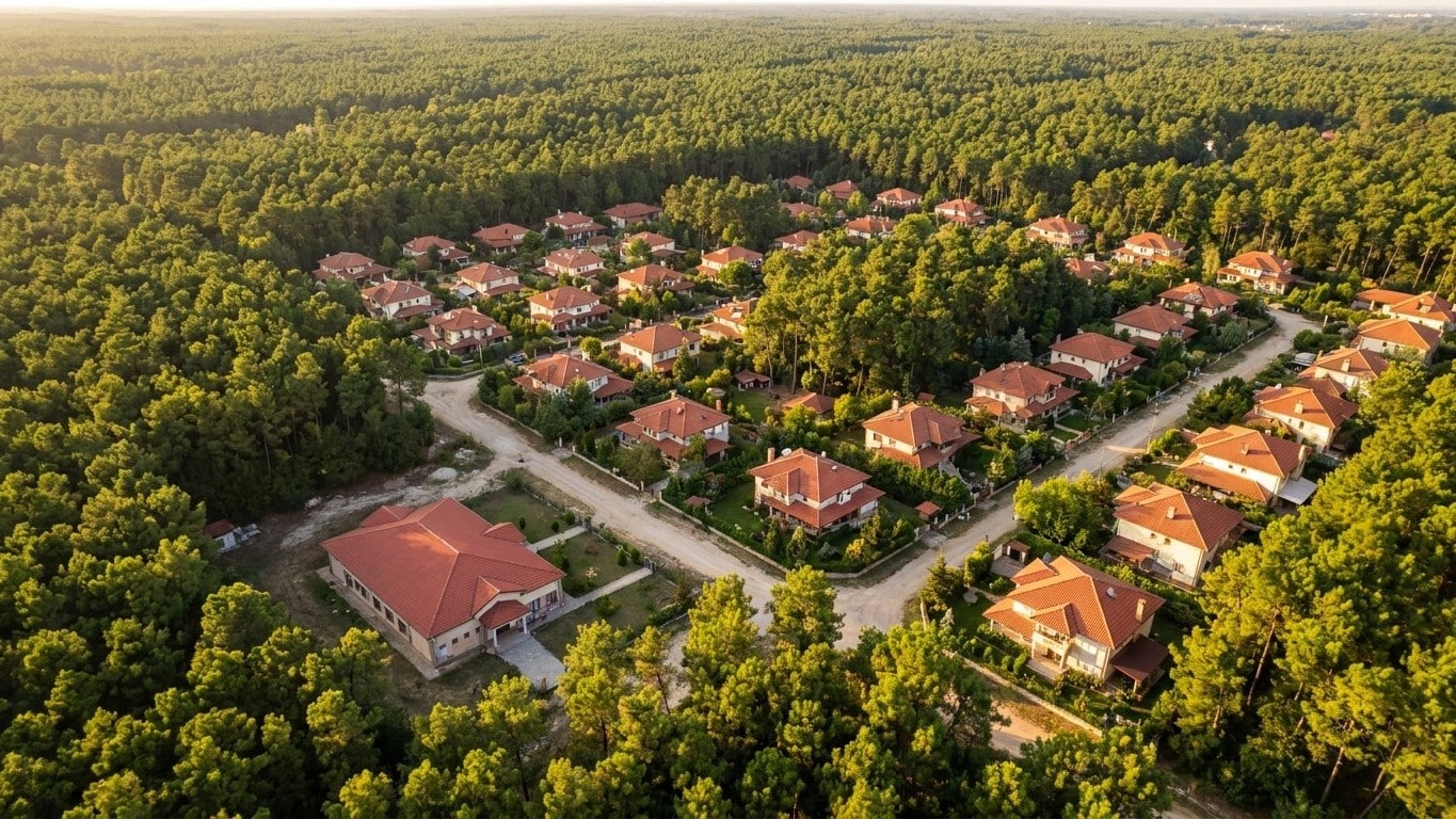
Nineteen thousand hectares of forest burned, one hundred buildings destroyed, and 140,000 people evacuated in a matter of days. The answer to the question everyone is asking this weekend — how can a fire directly threaten a metropolis of 800,000 inhabitants — is captured in one sentence: Bordeaux has never been separated from the Landes forest by a clear boundary. It grew right into it.
Key takeaways
- Bordeaux was never separated from the Landes Forest by a clear border — it grew into it
- A convective fire of unprecedented scale: 19,000 hectares burned in just three days
- Seventy years of patchwork urbanization have created “clearings” of houses among the pines, without a protective buffer zone
A Fire at the City’s Gates
On Friday, July 24, the Gironde prefect, Sophie Brocas, used a striking term: the situation was described as “XXL” and “unpredictable” at a press conference, with nearly 19,000 hectares already burned and 100 buildings destroyed. A steady west wind pushes the flames inland, toward the metropolitan area itself. The fire continues to advance toward the east of Gironde and the Bordeaux metropolis, driven by this persistent westerly wind.
The evacuation numbers are dizzying. Since Wednesday evening, at least 141,000 people have been evacuated, including 110,000 in Gironde and 31,000 in Landes, according to the Ministry of the Interior. Interior Minister Laurent Nuñez himself acknowledged the unprecedented nature of the situation: “We had never seen this, a convective fire of this scale,” meaning a fire that feeds itself and generates its own local climate. In response, the State deployed heavy artillery: Prime Minister Sébastien Lecornu announced the deployment of 500 additional soldiers, bringing to about 1,000 the number of troops on the ground facing the flames. A large-scale health plan followed, with 1.5 million FFP2 masks shipped overnight to Gironde to protect the personnel engaged and the populations exposed to the smoke.
On the ground, entire towns in the Bordeaux inner suburbs were put on evacuation alert. The measure affected residents of Saint-Médard-en-Jalles (33,000), Le Haillan (11,400), Saint-Jean-d’Illac (9,600), Martignas-sur-Jalles (8,000) and Saint-Aubin-de-Médoc (7,800), all close to or within the Bordeaux metropolis, while Mérignac (78,000) and Eysines (24,800), neighboring the city of Bordeaux, were partially affected. These are not remote hamlets hidden in the woods; they are communes with tens of thousands of inhabitants, just fifteen minutes by car from the historic center.
Why a Large City Remains Within Reach of a Forest Fire
The question deserves attention, because it contradicts a widely shared intuition: a metropolis, with its concrete, ring roads, and shopping districts, should stand as a natural bulwark against fire. That is not the case near Bordeaux, and the reason lies in the geography of the forest massif that surrounds it. The Landes forest is the largest artificial forest in Western Europe, covering 632,300 hectares, created in the 19th century on fairly poor sandy lands. It is not just a wood among others: it is a continuous monoculture of maritime pine stretching across three departments with no real interruption.
The major cities around the forest massif are Bordeaux to the north, Mont-de-Marsan, Dax, and Bayonne to the south. Bordeaux is not beside the Landes forest; it sits right on its northern edge, like a port on the edge of an ocean of pines. There is no wide agricultural belt, no river, or terrain feature to break the continuity of the forest cover between the heart of the massif and the first houses of the urban area. The maritime pine, a resin-rich conifer, grows in tight rows right up to the housing estates. This explains why a fire starting several tens of kilometers from the city center can reach Mérignac in just three days.
The Western Suburb, Built in the Forest, and Not Next to It
The second factor, even more structural, lies in the history of Bordeaux’s urbanization. The expansion of the Bordeaux metropolitan area, accelerated from the 1950s, has chipped away at the forest and vineyards of the western part of Bordeaux. The city did not stop at the forest’s edge: it gnawed the massif from commune to commune, neighborhood to neighborhood. In the northwest, Blanquefort, Le Taillan-Médoc, Eysines, and Bruges gave up a large part of their wooded areas, while to the west, in Mérignac, Pessac, Talence, and Gradignan, the urban fabric densified and large spaces were altered by the airport and the university campus.
The concrete result today: the municipalities evacuating this weekend, Saint-Médard-en-Jalles, Le Haillan, Eysines, Mérignac, are not merely neighbors of the forest. They are built inside it, in successive clearings carved into the massif over the decades, with suburban housing clusters weaving between plots of pine still exploited. Bordeaux-Mérignac Airport itself was developed on former forest land. This mode of strip urbanization, where housing and forestry interlock without a broad buffer zone, deprives firefighters of natural firebreaks where they would be most useful: just before the first homes. The phenomenon is not unique to this summer. The Landes forest in Gascony has also given way to urbanization that eats away more and more hectares, with over 18,540 hectares of forest consumed in twenty years, nearly four times the area of the city of Bordeaux.
This proximity between pines and houses is therefore not a calendar accident but the result of seven decades of urban planning that preferred nibbling away at the forest rather than bypassing it. The metropolitan fire prevention documents have long included requirements for clearing around homes at the forest edge, but this weekend’s episode underscores an obvious truth: as long as suburban neighborhoods remain embedded in the massif rather than separated from it by a true buffer zone, the question will stop being whether a fire can reach the urban area, and start being when.
Sources: x.com | franceinfo.fr
