
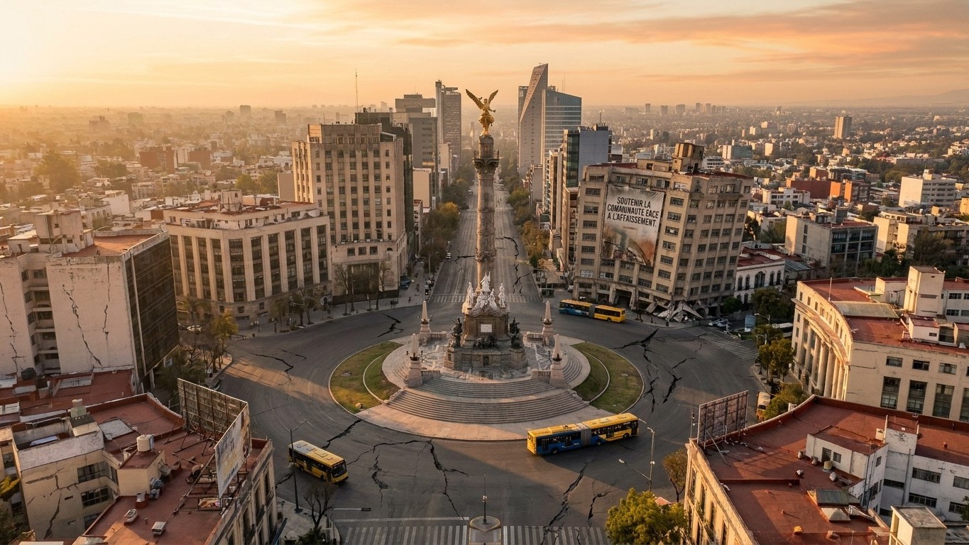
Twenty centimeters per year in some places, sometimes more: Mexico City isn’t merely sinking, it’s slowly collapsing in on itself. Since the early 20th century, the Mexican capital has lost several meters of altitude, a phenomenon so vast that it can be seen from space. The cause has been known for a century: to quench the thirst of a sprawling metropolis now home to more than twenty million residents, the city draws water directly from beneath its own foundations.
Key takeaways
- Since 1925, Mexico City has been sinking at a rate ranging from 2 to 35 centimeters per year, depending on the area
- The Angel of Independence required 14 extra steps simply to follow the ground that was sinking beneath it
- The real danger: some neighborhoods plunge while others remain still, creating catastrophic cracks
A city built on a lake that was drained twice
The story begins with Tenochtitlan. The Aztecs had founded their capital on an island in the middle of Lake Texcoco, set in a basin ringed by mountains. When the Spaniards arrived, they destroyed Tenochtitlan and began draining the lake to build atop it. The project never truly stopped: by 1900, the Valley of Mexico had been artificially drained through a 40-kilometer canal to the northeast of the basin and a tunnel through the surrounding mountains. As a result, the lake disappeared from the surface but not from the subsurface. The ground beneath still carries the memory of that vanished lake in the form of a thick, waterlogged clay layer.
It is this clay that causes the trouble. As long as it remains saturated, it supports the city’s weight. But the metropolis pulls water from within its borders to supply its taps: home to 21 million people, who consume nearly 287 billion gallons of water each year, the city has sunk more than 32 feet in the last six decades because roughly 70 percent of the water relied on is drawn from the aquifer beneath the city. Deprived of its water, the clay compacts like a wrung-out sponge—a phenomenon described as early as 1925 by soil physicist Karl Terzaghi. It is also worth noting that a Mexican engineer, Roberto Gayol, was the first to document the subsidence of the capital in that same year, nearly a century before satellites would confirm it.
What satellites see today
The numbers are staggering. It has been known since 1925 that a large portion of the city, where about 20 million people live, sinks at a rate that can reach 35 centimeters per year. A recent joint space mission between NASA and the Indian Space Research Organisation, named NISAR, confirmed and refined these measurements in late 2025 and early 2026. According to the data collected, certain zones sink on average about 2 centimeters per month, notably near the main airport and the Angel of Independence monument, which translates to roughly 24 centimeters per year.
The record of this drift is etched in the ground. The Angel of Independence, a 36-meter-tall monument crowned by a gilded statue, required the addition of 14 extra steps since its 1910 construction simply to keep its staircase level with the surrounding ground, which itself kept dropping. Over the course of a century, the ground has fallen more than 12 meters in some places, according to measurements cited by Mexican researchers. A 2020 study using Sentinel-1 satellite imagery measured local vertical movements reaching up to 39 centimeters per year between 2014 and 2020, with peaks surpassing 38.7 centimeters per year in the municipality of Nezahualcóyotl. Another study, published in the Natural Hazards journal, even reported a maximum subsidence rate of 423 millimeters per year in the city’s northeast sector.
A ground that buckles more than it sinks
The real danger lies not in how deep the subsidence goes, but in how irregularly the ground shifts. Mexico’s subsurface is not a uniform slab: depending on the clay’s nature, the thickness of the layers, and the history of pumping in a given area, some neighborhoods plunge while adjacent districts barely move. A researcher at the National Autonomous University of Mexico documented this phenomenon in detail: a 2024 study showed that some regions sink at as much as 50 centimeters per year, while others move barely at all—a jagged subsidence that is especially hazardous because major networks of infrastructure cross zones that move at different speeds. The image that naturally comes to mind is a rug being pulled from one corner while the opposite side is nailed to the floor: it doesn’t simply descend; it buckles.
That is precisely what harms the Metropolitan Cathedral, perched on the Zócalo since the 16th century and partly resting on the ruins of the former lake. Its slow, progressive sinking into the marshy ground of the old Texcoco lake required substantial stabilization work at the end of the 20th century to preserve its structure. The rescue project, undertaken during Ernesto Zedillo’s presidency, employed an engineering method already used elsewhere: an excavation approach akin to the one used to reinforce the foundations of the Leaning Tower of Pisa. The same imbalance also cracks water and sewer pipes throughout the city, triggering cascading leaks: a vicious circle, since every leak necessitates pumping more to compensate, which in turn accelerates subsidence.
Too little water, too much water
The paradox is cruel. Mexico City lacks safe drinking water, yet it regularly floods during the rainy season. The National Water Commission (CONAGUA) records chronic deficits in the aquifers that feed the metropolis: the principal regional aquifers show deficits of 561, 112, 106, and 23 million cubic meters per year, depending on the sector. At the same time, subsidence alters the city’s topography to the point of reversing natural drainage: rather than surfacing, polluted water from the upper aquifer now migrates into deeper layers, contaminating wells, while more than a million residents still lack access to potable water. A study estimates that more than 751,000 properties are now more exposed to flooding due to this subsidence, with structural distortions that weaken entire buildings in several neighborhoods.
Reducing the phenomenon would require a drastic cut in pumping, either by importing water from neighboring basins or by capturing rainwater on a larger scale—measures already explored by the authorities but not yet yielding sufficient results. Yet the compacted clay does not rebound like a sponge laid back in water: once compacted, altitude loss is irreversible. What Mexico gains in urban surface area over a century, it loses, meter by meter, underneath.
Sources: sciencedirect.com | yahoo.com
