
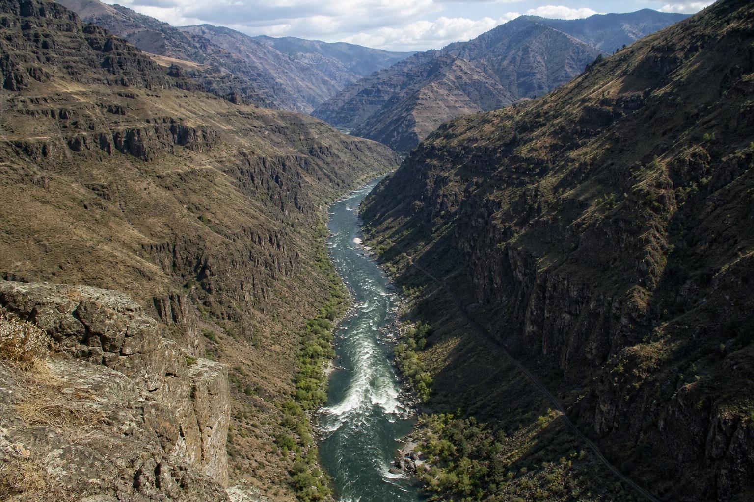
Most travelers arrive in the American West assuming the famous Arizona chasm holds every superlative, but maps and measurements tell a different story. On the Idaho–Oregon line, a darker, quieter trench cuts the continent, braiding cliffs and lava with the relentless Snake River. People who finally stand at its rim tend to whisper the same thing: “I didn’t know it was this deep.” Then the wind rises off the river, and the place answers with silence.
How deep is deep, exactly?
By a strict rim‑to‑river measure, this volcanic corridor drops about 7,993 feet (2,436 meters), which is roughly 1,900 feet—nearly 600 meters—deeper than its famous Arizona counterpart. Depth here is not just a number; it’s a feeling of verticality, with slopes that plunge from forested summits to desertlike benches scattered with sage. The river far below looks almost thin, until a jet boat marks it with a wake and the canyon’s scale clicks into place.
Carved by the Snake, built by fire
Unlike the staircase of sandstone and limestone down south, these walls wear armor of basalt, the legacy of Miocene flood lavas that smothered the region in fire. Tectonic uplift raised the Seven Devils on the Idaho side and the Wallowas on the Oregon side, while the Snake River gnawed a corridor between them. Layer by layer, water worked its patience, exploiting fractures, hauling gravel, and sawing a groove so steep it seems to breathe. “Rivers don’t hurry,” a local guide likes to say. “They just never stop.”
A wilder feel, and a different sound
Here, “crowd” means a pair of bighorn sheep skittering over slate and a kettle of eagles riding the thermals. The soundscape is wind, water, and the dry chime of stones under a lizard’s feet. Nights are ink‑black, with the river murmuring like a faraway train. The canyon sits inside the more‑than‑650,000‑acre Hells Canyon National Recreation Area, where trails slip through ponderosa savanna and riverbars bloom with purple lupine. You may hike all morning and meet only your own footprints.
Older stories in the stone
Long before dams or dirt roads, Indigenous peoples traveled this river, left petroglyphs, and shaped seasonal routes that stitched salmon, roots, and game into a living calendar. Their presence is not past tense; it is ongoing, visible in place names and sites that deserve care. The canyon also holds harder truths, including an 1887 massacre of Chinese miners—a reminder that Western history is both magnificent and bruised. “If you come only for scenery,” an interpretive sign suggests, “you’ll miss half the story.”
Ways to feel the depth
Because roads and viewpoints are scattered, you build your own itinerary. A few classics:
- Hat Point Lookout (Oregon): a high, airy perch above the Imnaha, reached by a steep gravel road that opens in late spring.
- Heavens Gate Overlook (Idaho): a skyline balcony near the Seven Devils, with long views into river‑cut darkness.
- Snake River Trail #102: a contoured path along the water, ripe with spring wildflowers and autumn gold.
- Jet‑boat or rafting trips: from below Hells Canyon Dam, outfitters thread wild rapids and canyon light.
- Pittsburg Landing (Idaho): a campground and launch tucked into a warmer, palm‑of‑the‑hand bend.
Know before you go
Remoteness is part of the charm, and part of the risk. Summer at river level can feel desert‑hot, while ridgetops still hold snow. Expect spotty or zero cell service, frequent road washouts, and long drives between services. Bring extra water, sun protection, and a frank respect for rattlesnakes. Certain river sections use permit systems, especially in peak season, so check current regs with the Forest Service and outfitters before you launch. The seasonal visitor center near Hells Canyon Dam can help decode the latest details.
Deeper doesn’t always mean louder
If the Arizona canyon is a cathedral, this one is a cloister. Marketing never crowned it the default road‑trip stop, and the terrain keeps casual visitors at the edges. That’s a feature, not a flaw. The scarcity of paved viewpoints saves the surprise for those who work a little harder. Stand at Hat Point on a blue‑swept morning and you’ll feel it: wind through bunchgrass, a hawk stitched to the sky, and a river so far below it seems like memory moving.
Geology you can touch
Press your palm to a sun‑warmed basalt column and you can read a short, stark sentence: cooled fast, cracked clean, then lifted. Walk a mile and that sentence becomes a whole book—intrusions, pillow lavas, and metamorphic scraps from old oceanic crust flaked onto the continent’s margin. Erosion edited the text; the Snake River did the proofreading. “Every bend is another chapter,” a hiker joked, “and the ending keeps getting lower.”
What the river teaches
Spend a day on the water and you start noticing scale differently. A cliff that looks “near” from the rim is an afternoon of paddling away. A rapid that sounds modest from shore becomes a standing wave with shoulders. The boat hums, the canyon narrows, and time loses its neat edges. Depth here isn’t about beating a record; it’s about how a place rearranges your internal yardstick—how wildness fills the frame, and then spills beyond it.
If you’ve been measuring the West by postcard fame, consider recalibrating by feel. Come when the balsamroot is blooming, or when September edges the hills in amber. Walk, float, or simply sit and let the river say its piece. The number is impressive; the experience is deeper.