
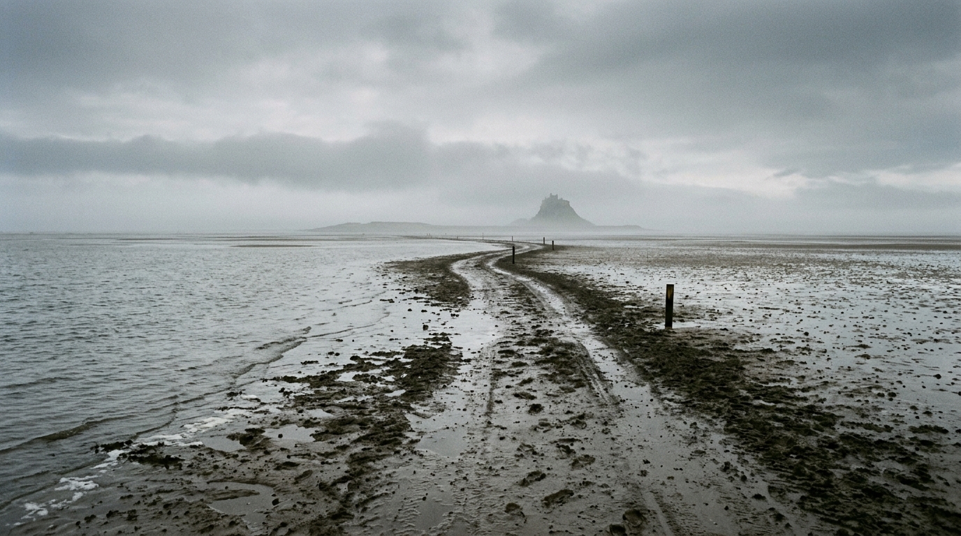
And what if the greatest danger of a hike wasn’t the slope or the weather, but the ground itself? On the east coast of Essex, in England, there exists a path that locals avoid using unless they know its rules inside out. Not because it climbs along a cliff face or passes through a hostile forest, but because it winds through miles of tidal flats where the sea plays hide-and-seek with walkers. This British route reminds us that a seemingly tranquil stroll can turn into a deadly trap in minutes. Here is the story of the path that is nicknamed, with a blend of dark humor and respect, the Doomway.
- The Broomway links Wakering Stairs to Foulness Island across 10 km through the Maplin Sands mudflats, historically marked by brooms planted in the mud.
- The main danger is the rising tide, which advances faster than a human on this flat terrain and can overwhelm a walker in minutes.
- The path leads to Foulness Island, home to an active military firing range where unexploded shells can still be present.
- A path marked by upside-down brooms sticking up from the mud
- A tide that beats any sprinter
- When fog erases all landmarks on miles of mud
- A military island where shells still sleep beneath the mud
A Path Marked by Brooms Standing Upright in the Mud
The Broomway links Wakering Stairs to Foulness Island, across the Maplin Sands mudflats. Its route is not linear: it starts eastward for about 400 metres, then tracks the coastline toward the northeast for nearly 8 kilometres, until it reaches firm ground at Fisherman’s Head. In total, it is indeed the 10 kilometres referenced by its grim nickname that separate hiker from start and finish.
Its name, the Broomway, derives from an old and clever practice: brooms were planted into the mud, head-up, to mark the path when the sea withdrew. This rudimentary yet effective marker was used for centuries, as the route is said to have been in use for at least 600 years, perhaps since the Anglo-Saxon era, or even before the Romans arrived on the island. Archaeological digs have even shown that the southern section of the path was reinforced with wooden props, evidence that the crossing was frequented enough to justify improvements. Since the 18th century, upkeep of this marker has been funded jointly by the local parish and the island’s main landowner, illustrating the long-standing role of this route in connecting Foulness to the mainland.
A Tide That Outruns Any Sprinter
This is where the true danger of the Broomway lies, and it has nothing to do with terrain or fatigue. The principal risk is the rising tide, whose speed far exceeds that of a human, even when sprinting. On these flat, featureless mudflats, water can flood the landscape in mere minutes, first reaching the hips, then swiftly the chest of an unsuspecting walker.
This characteristic turns a simple timing mistake into a potentially fatal situation. Unlike a tide that would rise gradually along a conventional beach, the Maplin Sands tide advances across almost-flat ground, allowing it to gain ground at a terrifying pace. It is therefore not a theoretical risk, but a relentless physical reality: on this coastline, the tide does not warn, it swallows.
When Fog Erases All Landmarks Across Miles of Mud
If the tide is the most immediate danger, it isn’t the only one. The Broomway traverses an environment where disorientation can set in very quickly, especially in fog or rain. With no relief, no trees, no fixed reference point, it becomes easy to lose your sense of direction on these expansive mudflats. A walker who strays, even slightly, from the initial route may find themselves trapped far from safety at the exact moment the tide begins to rise.
In addition to this difficulty are other real traps: quicksands scattered along the route, as well as shell craters filled with soft mud, remnants of artillery fire conducted across this zone. The ground itself, outwardly stable, can prove treacherous with every step, making the crossing far more complex than a simple walk in a straight line along a beach.
A Military Island Where Shells Still Sleep Beneath the Mud
The Broomway does not lead to just any destination. Foulness Island houses a military firing range, established in the 19th century by the British War Office. Today the site is still managed by the Ministry of Defence and is used to test weapons and ammunition, which explains the continued possibility of unexploded ordnance in the vicinity of the path and on surrounding lands.
Despite this unusual context, life continues on the island: a few families still cultivate wheat, barley, peas, and flax on leased land, in a landscape where farming and military activity coexist. In 1922, the army constructed a road and bridges linking Foulness to Wakering Stairs, which rendered the Broomway technically obsolete for everyday travel. Yet some walkers still use it, drawn by its ancient history.
This ten-kilometre path ultimately sums up a simple yet essential lesson: nature does not need vertiginous peaks or freezing temperatures to be unforgiving. A flat mudflat, an ancient marker made of brooms in the mud, and a pressing tide can turn a stroll into a race against time. So, the next time a path seems too calm to be dangerous, perhaps it is worth recalling the Doomway’s story before stepping onto it with eyes closed.
