
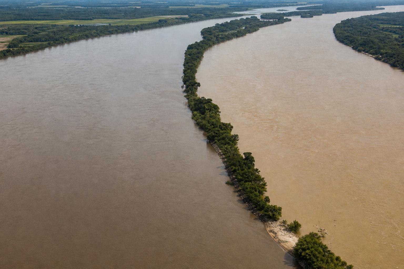
Many of us grew up tracing the Mississippi on a wall map, certain it reigned as America’s longest river. The truth bends like a wide meander: the Missouri is actually longer, edging ahead by more than 30 kilometers. Once you look closely at sources, channels, and where waters join, the ranking quietly flips.
Why the Map Misled You
Textbooks favored the iconic Mississippi, a name with outsize cultural force. “Big rivers make big myths,” and this one lingered in classrooms and atlases.
Cartographers long prioritized the main-stem name over the hydrologically longest path. When the Missouri flows into the Mississippi, it donates more water, more sediment, and, crucially, more total distance.
Meanders, Sources, and the 30-Kilometer Edge
By prevalent measurements, the Missouri stretches about 2,341 miles (3,767 km), while the Mississippi runs roughly 2,320 miles (3,730 km). That’s a margin of a bit over 20 miles—some 34 kilometers—enough to change the record.
“Length is a moving target on a living river,” say geomorphologists, because channels migrate, oxbows cut off, and dams smooth formerly wild bends. Even definitions of a river’s source can shift numbers, depending on which headwater tributary you trace.
A River System, Not Just a Rivalry
Hydrologists often see a single, braided system, not two rivals vying for bragging rights. If you track the longest continuous path—Jefferson to Missouri to Mississippi—you reach a colossus more than 3,900 miles (about 6,275 km).
That system rivals the world’s giants, depending on how sources and mouths are defined across global basins. The label you choose changes the league table, but the water keeps flowing.
How We Count a River
Three choices tend to rule the debate: where the river begins, which channel counts as the main stem, and how tightly we measure a wandering line. Satellite tools sharpen the picture, yet human criteria still draw the frame.
Choose the longest headwater tributary, and the story tilts one way; privilege the traditional name, and it tilts another. “Measurement is method made visible,” and methods carry quiet biases.
Stories Flowing Downstream
The Missouri carved a corridor of Indigenous trade and knowledge long before Lewis and Clark logged their pages. On its banks, “distance becomes story,” braided with buffalo, cottonwoods, and winter ice.
The Mississippi shaped ports, blues, and steamboat economies, becoming a national metaphor for breadth and change. In public memory, cultural magnitude often outruns hydrologic magnitude.
Science in a Restless Channel
Rivers constantly remodel themselves, and engineers constantly respond. Cutoffs shorten reaches; reservoirs drown old meanders; levees stiffen a once-fickle edge.
Even small surveying choices—bankline versus thalweg, seasonal flow stage—can add or subtract miles. The longer you look, the more the numbers breathe.
Why the Difference Matters
- Navigation charts and funding priorities sometimes follow headline metrics, shaping dredging, locks, and ports.
- Flood models need accurate main-stem hierarchies to forecast where water will go.
- Conservation plans hinge on sediment and nutrient budgets that the Missouri heavily drives.
- Public storytelling and education benefit from accuracy that also honors river complexity.
Numbers With Context
Citing ballpark figures keeps us honest without feigning false precision. The Missouri at about 3,767 km and the Mississippi at about 3,730 km are defensible, widely used estimates.
Different agencies may publish slightly different totals, often reflecting method or survey date. “Rivers are verbs, not nouns,” which is why their lengths refuse to sit still.
The Confluence as a Crown
Stand at the meeting of the Missouri and Mississippi near St. Louis, and the water’s mood changes. Turbid plains-born energy surges into the broader, southbound current.
Hydrologically, the upstream branch with greater length, discharge, and basin area often claims the main lineage. By those tests, the Missouri carries the crown’s weight.
What the Classroom Missed
The familiar lesson wasn’t a lie, just an oversimplified frame. Education loves the clean answer, yet rivers reward a curious question.
When we revisit our maps with better lenses, the landscape returns the favor with better truths. “Update the story, and the story updates you.”
How to Hold Two Truths
It’s fair to call the Missouri the nation’s longest single-named river, by prevalent length metrics. It’s also fair to treat the combined system as one monumental waterway, dwarfing either name alone.
Either way, the continent’s central artery remains a study in motion, power, and scale. Names draw boundaries; the water ignores every drawn line.