
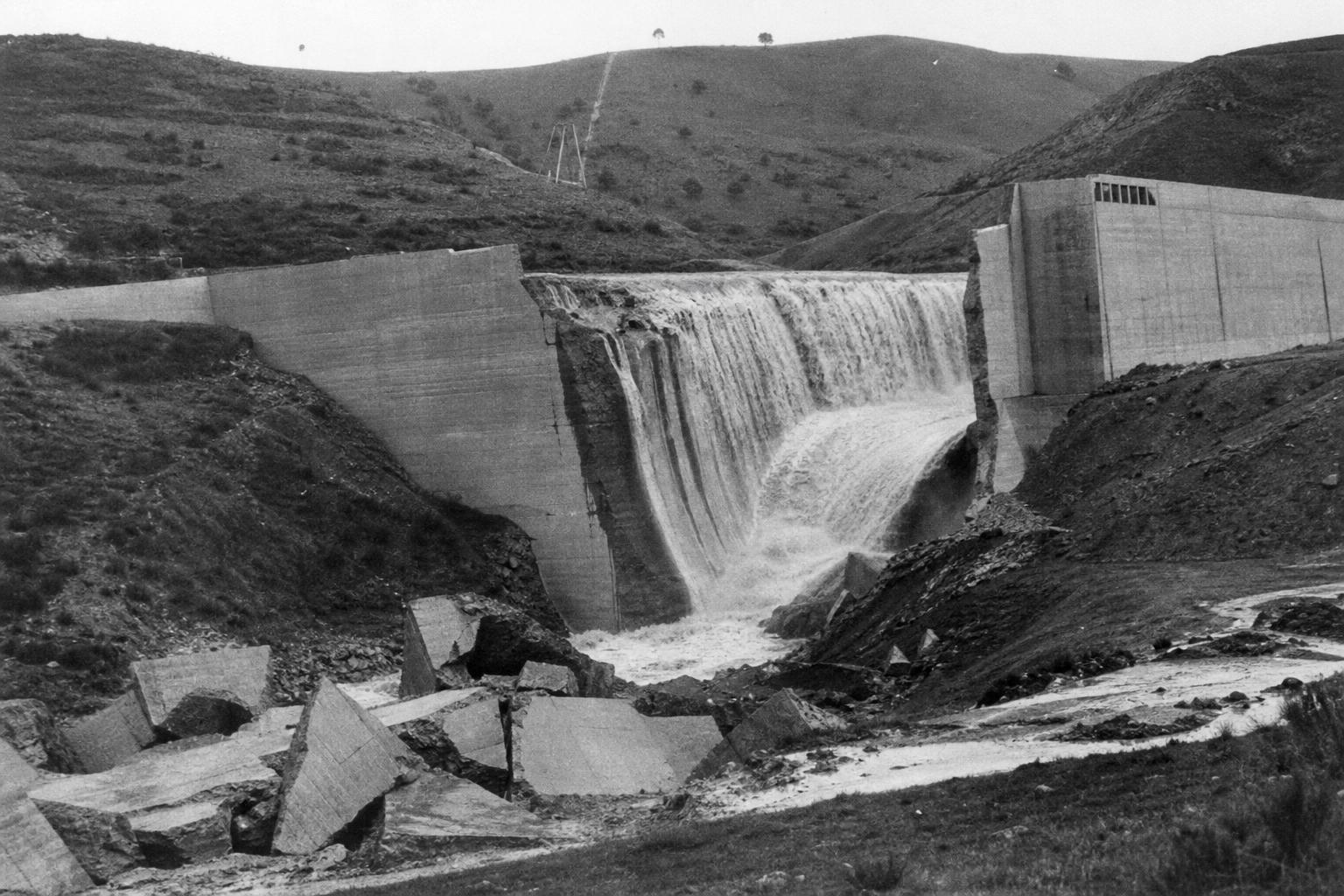
Dawn broke over San Francisquito Canyon with a cool stillness, the kind that makes engineers confident in their work. By midmorning, the celebrated builder who had delivered water to a thirsty Los Angeles peered along the crest of his 56‑metre wall, studied its damp seams, and pronounced it sound. Twelve hours later, the canyon howled with a black, churning torrent that erased ranches, power camps, and whole families on its way to the sea.
A city’s thirst and a single point of failure
Los Angeles in the 1920s was a boomtown, swollen with ambition and short on rain. The long aqueduct from the Owens Valley—an audacious, controversial lifeline—had made the city’s explosive growth possible. But a pipeline needs buffers, and buffers need reservoirs. The St. Francis Dam rose in a narrow, folded canyon as a backup, an unglamorous but essential stopgap for a growing metropolis.
Built quickly and raised in stages, the concrete monolith stood like a promise to keep taps flowing and turbines spinning. Its setting, however, was a geologic riddle—layered schist, ancient slide debris, and rock that looked sturdy but sheared under stress.
The morning visit
Early on March 12, 1928, leaks traced lacework patterns across the downstream face, threading through joints that had worried local workers. The chief engineer and his deputy walked the crest, peered at seepage, and labeled it manageable—the kind of sweating a massive dam might show as it settled.
“Heavy dams always leak,” was the day’s unspoken logic. The reservoir sat high, the outlet valves partly open, and the mood—if not relaxed—was assured. “Keep an eye on it,” was the rough verdict, and the two men drove back toward the city’s humming grid.
Night fell. Shortly before midnight, a crack like artillery split the air, and the eastern abutment let go. What followed was not a trickle or a surge, but a moving continent of water—roughly 12 billion gallons unleashed in minutes.
What really failed
The dam did not simply “break”; the ground beneath and beside it betrayed the structure. The east side had been keyed into an old landslide mass, a patchwork of weak, weathered, and water‑sensitive rock. Seepage lifted at the base, reducing friction; the reservoir’s near‑maximum head bore down with quiet, relentless force.
Design choices sharpened the knife’s edge. The crest had been raised without widening the base, trimming the safety margin at the abutments. Drainage galleries and relief wells—common in later practice—were meager or absent. Instrumentation to read uplift, movement, and pore pressure simply didn’t exist on the site.
As one judge of such failures might put it: “Nothing fails like success pursued too far.” Confidence became vulnerability.
- Key misjudgments: weak abutment geology, inadequate drainage, heightened load without proportional base width, and limited monitoring—each small on paper, catastrophic in combination.
The night the canyon roared
When the wall went, it went in segments. Whole blocks tumbled, scoured, and slid, releasing a steep, black front that hurled boulders and concrete like toys. Camps of power workers vanished under a boiling slab of water and debris; ranch lights winked once and were gone.
The flood followed the canyon to the Santa Clara River, gathering trees, bridges, livestock, and homes. It tore through the valley past communities like Fillmore and Santa Paula, hammered Saticoy, and reached the Pacific near dawn. Many never woke; others clung to rooftops, windmilled into branches, or rode mattresses and doors as makeshift rafts. By morning, at least 431 people were dead—an official count that still understates the loss.
Survivors spoke of a “black wall” that “growled,” of a smell like wet cement, of silence after the roar, punctured by a few thin voices calling names across the mud.
Aftermath and accountability
In the hearings that followed, the city’s star engineer sat small behind a large name. He told the panel, “Don’t blame anybody else, you just fasten it on me.” It was not theater; it was the plain sentence of a man whose judgment had been wrong on the only day that mattered.
Investigators mapped the busted abutment, traced the seepage, and diagrammed the choices that turned risk into ruin. New rules flowed from the wreckage: stricter geologic surveys, independent design reviews, better drainage, and real‑time monitoring. California reorganized dam safety; other states soon followed.
The project that had symbolized metropolitan reach now stood as a caution against unexamined certainty.
Lessons flowing forward
Modern dams brim with devices that earlier builders did not have: piezometers, inclinometers, fiber‑optic sensing, automated sirens, and satellite‑based surveys that can read millimeters of movement across a year. We plot paleolandslides in three dimensions, drain pressure before it climbs, and design for what water inevitably does—seek paths, lift masses, and exploit the smallest weakness.
And yet the core lesson remains stubbornly human. Pride is a poor instrument; geology wins every argument. When doubts surface—seepage patterns change, a tilt increases, a noise returns—engineers must assume the worst and act like time is already gone.
“Water finds a way,” the old saying goes. Our task is to map that way before it maps it for us. In a quiet canyon one spring night, the cost of getting it wrong became unforgettable—measured not in diagrams or reports, but in miles of wet ruin and in names that never made it to morning.