
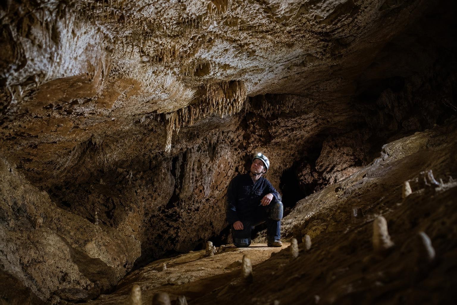
The world’s longest cave is still growing—not in rock, but in the map that tries to contain it. Beneath Kentucky’s rolling hills, a spiderweb of passages bends through limestone, collapsing distances and stretching time. More than 425 miles have been surveyed, and some geologists quietly suspect that nearly 600 miles more could still sleep in the dark. “Every new junction is a question, every passage a possible answer,” a park cartographer once told me, half-grinning, half in awe.
A limestone labyrinth still writing itself
Mammoth formed in stacks of Mississippian limestone, a karst layer-cake riddled by water that seeps, swirls, and eats. Acidic rain percolates through soil, dissolving calcite and chiseling voids along bedding planes and joints. Over geologic time, underground streams captured surface creeks, hollowing canyons within rock and leaving abandoned levels like ghost highways.
This place is not a single tunnel, but a multi-level city, each floor marking a past river stage. Uplift dropped water tables, rivers cut deeper, and older galleries fell silent. The result is an atlas where vertical stacks of dry corridors overlie active streams, and sinkholes on the surface act like unlocked doors.
How explorers extend the map
The modern mapper carries more than rope and bravado. Cave surveys still start with legs and tape—now laser distos—but the work hums with carefully stacked measurements, sketched on waterproof paper or tablets in mud-slick silence. “Slow is fast in a cave,” an expedition lead likes to say, meaning precision beats heroics.
- Core tools include laser rangefinders, digital compasses and inclinometers, dye-tracing kits, waterproof tablets with cave-survey apps, and selective LiDAR or photogrammetry where conditions allow.
Dye tracing is the oracle of karst: fluorescent dyes vanish into a sink and reappear at a spring, proving hidden links. Where air moves, explorers sniff drafts for clues; cold breath in summer can betray a passage ahead. In breakdown piles, a paper-thin breeze can be as thrilling as a shout. Data later resolves into maps—not just pretty lines, but hydrologic hypotheses that guide the next push.
What remains hidden
Why might so much still be missing? First, the scale is crushing. A honeycomb this vast hides doors behind collapse, clay plugs, underwater sumps, and tight pinch points that thwart teams and tools. Second, the geology is clever. Insoluble sandstone caps can seal levels; then one broken contact becomes the only entrance for miles.
Third, the system is not singular. Nearby networks—Flint Ridge, Roppel, and Fisher Ridge—have merged before, and hydrology hints at more marriages to come. Dye traces and spring chemistry whisper of corridors still unseen. “We’re mapping a weather system in stone,” a geologist told me, emphasizing the living, changing character of groundwater flow.
Life in the dark
Absence of light doesn’t mean absence of life. In the quiet black, troglobitic species—colorless crustaceans, blind fish, delicate spiders—specialize with breathtaking precision. Metabolisms run lean, senses shift to touch, and ecosystems depend on slow drips of nutrients: bat guano, flood-borne detritus, microbial films.
Bats once poured from entrances like smoke, a river of wings and sound. White-nose syndrome carved that river to a rivulet, turning an ecological engine into a fragile whisper. Park scientists tread with care: fewer disruptions, tighter protocols, and a renewed reverence for the costs of simple presence.
Tourism, tension, and time
Millions come for the hush and the echo, guided by lantern glow through rooms big as auditoriums. Tourism funds science and stewards jobs, yet every footprint is a small argument with fragility. Managers choreograph seasons, close sensitive gates, and route tours to protect speleothems as tender as frost. “Access is a dial, not a switch,” one ranger notes, explaining how policy bends with conditions.
Human history here runs deep. Indigenous peoples mined minerals, left cane-torch smudges, and used these spaces as workshops long before modern maps. Later, saltpeter diggings, nineteenth-century spectacle, and early tourism layered story over stone, a palimpsest you can almost hear when the guide’s light clicks off.
Why scale still matters
Size is not mere bragging; it’s insight. Long cave systems are libraries of paleoclimate: stalagmites archive drip chemistry, recording rainfall, temperature, and even storm rhythms. Water tracing protects wells, informs agriculture, and helps planners avoid building over sinkholes that quietly move. In a warming world, aquifer resilience and contamination paths become questions you answer with maps.
Globally, Mammoth stands beside China’s Shuanghedong and Mexico’s Sac Actun, not as a rival but as a complementary teacher. Each system writes in a different dialect of karst, offering case studies in hydrology, ecology, and human impact. Here, the curriculum is sheer length—a volume big enough to reveal rare patterns and outliers that smaller caves might hide.
Some places feel finished when the brochure is printed. This one refuses the period. The draft that slips past your cheek, the dye that appears days later, the survey shot that breaks a round number—each is a nudge from the underworld, urging patience and curiosity. “We’re not conquering the cave,” a veteran mapper once said. “We’re learning to read what it already wrote.” And there, in that stubborn text, the blank pages are likely the longest of all.