
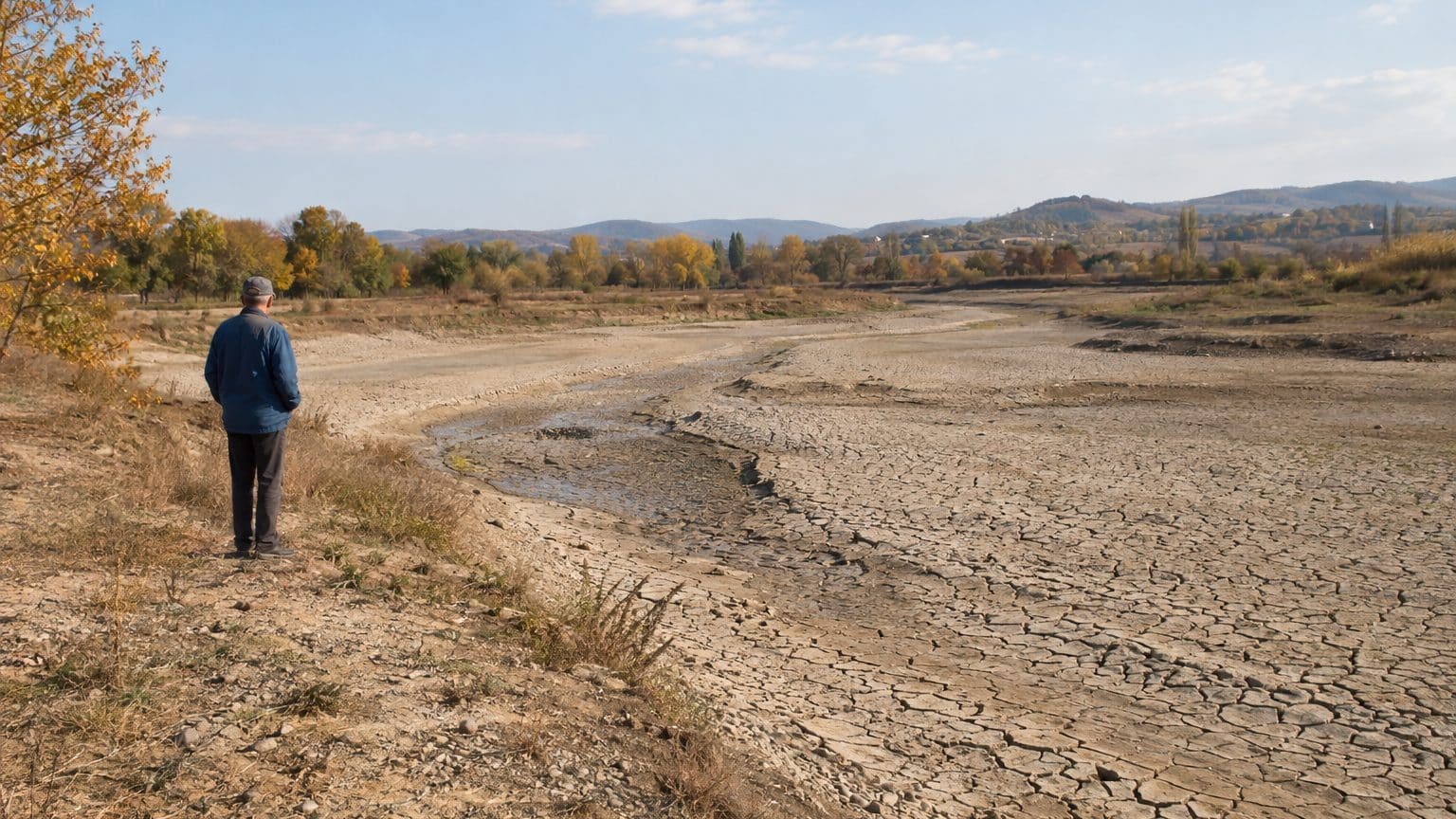
In 1997, the Lijin hydrometric station, located in Dongying in Shandong Province, recorded 226 days with no measurable flow. It was the last station before the Yellow River’s mouth, about 100 kilometers from the sea. For more than half of that year, nothing at all reached the shore.
These 226 days represent an annual total, not a continuous stretch.
That nuance matters, because figures vary from one document to another, and some put forward markedly longer durations. The 226 days at Lijin is the only figure that is well established, and the only one that can be quoted without reservation.
The idea circulates readily: by building dams to feed northern China, the river would be cut off from its estuary. The reality is more nuanced. The identified causes point first to water withdrawals, especially for irrigation, well before the works themselves, and the decline in rainfall is a secondary factor.
- The Lijin station recorded 226 days without flow in 1997.
- Irrigation, five times higher than in 1950, is the main cause of the drying up.
- Water quotas by province brought the river back to the sea in 1999.
From 1972 to 1997, a river drying up for longer and longer periods
The first drying event reaching the sea dates back to 1972. In the following two decades, the phenomenon remained contained: between 1970 and 1990, the Lijin station rarely exceeded 20 days per year without flow. After 1990, the rise was steady. The record of 1997 represents more than 11 times that 20-day threshold, and roughly 62% of the year.
The Yellow River runs for 5,464 kilometers, sustains 12% of China’s population, irrigates 17% of the country’s arable land, and feeds more than 50 large and medium-sized cities. In 1997, 704 kilometers of its bed were dry, about the driving distance between Paris and Toulouse.
That year, Lijin saw only 1.8 cubic kilometers of water pass by.
That volume is equivalent to roughly 720,000 Olympic-sized pools of 2,500 cubic meters each. If translated to France, it would mean the Loire would fail to reach the Atlantic for more than seven months out of twelve, though such a comparison has its limits.
When Lijin is dry, the roughly 100 kilometers separating the station from the sea receive nothing from upstream. The Yellow River empties into the Bohai Sea at Dongying, and it is this downstream stretch that bears the brunt. Wetlands in the delta degrade, and the coastline is eroded by the sea.
Irrigation, cities, and factories: where did the water go?
Since 1950, irrigation has been multiplied by five. In addition, domestic and industrial needs of cities and factories have grown within a basin that the river traverses across seven provinces and two autonomous regions.
Rainfall has declined by about 12% compared with the 1950s. This secondary factor worsens the shortage but does not fully explain it. The bulk of the deficit comes from volumes withdrawn from the riverbed for the fields, taps, and workshops.
The question of dams remains central to the shortcut. They are part of the basin’s landscape, but nothing justifies attributing the drying up to them alone: it is the volume drawn off, especially for irrigation, that is missing downstream.
The consequences first appeared in daily life. More than 100,000 residents—the scale of a city like Rouen—had to queue every day to obtain drinking water. Some crops were lost. Some factories were shut down.
1999: provincial quotas, and the water returns
On March 1, 1999, the river commission set quotas for water by province.
Ten days later, water began to flow again at Lijin. By August 12, 2024, the river had been flowing without interruption for 25 years. That’s a quarter of a century without a dry spell at the last station before the estuary.
A child born in 1999 has therefore witnessed the river flowing uninterrupted at Lijin for their entire life. The 226 days of 1997 belong to a time they never knew.
The principle can be summed up in a few words: each province receives a fixed share of water in advance, rather than drawing water with no ceiling. The river commission draws up each year a distribution plan, with a volume limit for each province traversed. Withdrawals become an annual budget, plus an open faucet.
For a province, such a ceiling would force compromises among fields, cities, and factories. The weight of irrigation—multiplied by five since 1950—would necessarily be debated. As for the downstream, it would stop depending solely on what the upstream allows through. These effects remain inferences: the real arbitration is not visible in the available data.
In my view, this episode is a lesson for any overburdened watershed: a provincial withdrawal cap was enough to reopen the riverbed within ten days, after years of progressively longer dry spells. An additional dam does not create water; a quota decides who gets it.
A steady flow, by itself, does not reveal the volume carried. In 1997, the station recorded only 1.8 km³, spread across the 139 days when the river still flowed. That volume, more than the number of dry days, measures what the river delivered to the sea at that time.
👉 A small gesture for Space Group? Follow us on Google, add us to your bookmarks, and find us on Google News so you don’t miss any discoveries.
