
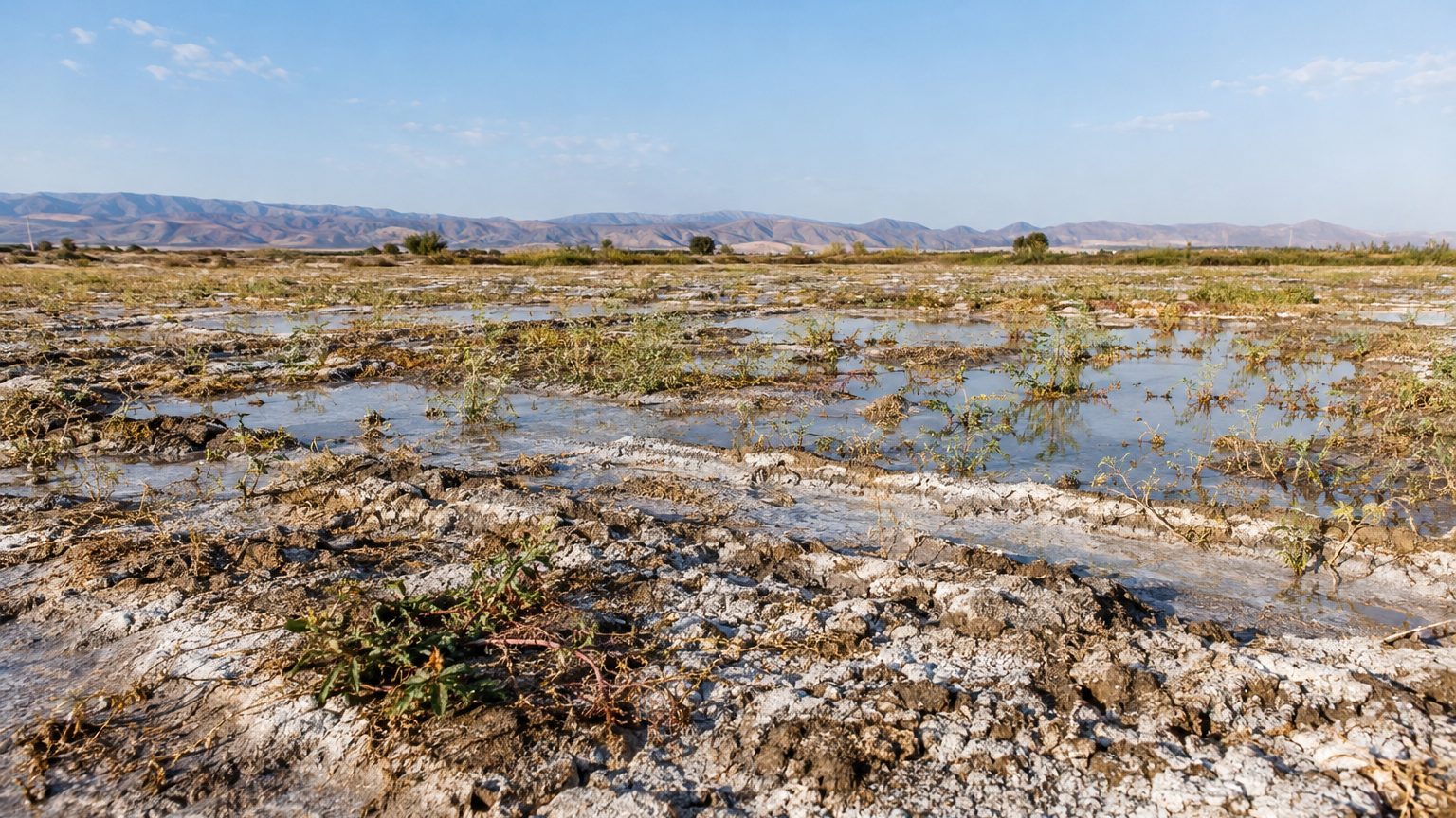
The Indira Gandhi Canal, 837 km, the longest in India, has carried water from the Himalayas to the Thar Desert in Rajasthan since 1958. It has kept its promise: wheat and cotton fields now cover lands that previously yielded nothing. Yet the water did not stay on the surface. It seeped down, raised the groundwater table, and saturated soils that had never been designed to receive it. “Drowned” is a strong word for an entire state, but field measurements give a sense of the scale of the phenomenon.
The Indian Council of Agricultural Research assesses the damage at 34.25% of the studied zone.
- The Indira Gandhi Canal, at 837 km, greened the Thar Desert yet created zones waterlogged by infiltration.
- Rising groundwater and intense evaporation deposit salts on the surface, degrading cultivable lands.
- 165 km² of irrigated lands suffer from waterlogging and salinity, an area equivalent to 1.5 times Paris intra-muros.
A Project Launched to Push Back the Desert
The project began in 1958 under a different name. It would be renamed Indira Gandhi Nahar Pariyojana in 1984, according to a study dedicated to perimeter congestion issues. The stated objective was to transform sandy, arid land into productive agricultural zones.
On paper, the wager seemed won. The presence of water and the accompanying plantings greened the landscape and reduced wind erosion, which also limits the silting of canal structures. Wheat and cotton appeared in a region where extensive livestock farming had predominated, and the canal also provides drinking water to several districts.
The downside emerged gradually, at the pace at which plots were irrigated.
When the Groundwater Rises Beneath the Fields
Before the canal, the groundwater lay far below the Thar soil. Infiltration from the banks, excess water in cultivated plots, and accumulation in depressions raised its level. The intense heat and evaporation then do the rest: dissolved salts rise and deposit on the surface or in the shallow soil layers. Waterlogging and salinization advance in tandem, and the latter degrades the fertility that the former was meant to create.
Geography worsens the problem. In the Tibbi and Rawatsar areas, the relief offers no natural outlet for the excess waters, which stagnate in depressions. This still water then recharges groundwater in neighboring lands, even those not over-irrigated.
Several studies point to the lack of drainage suited to the incoming water.
What the 34.25% Figure Really Measures
The data come from a study published in the Annals of Arid Zone, a journal hosted by ICAR, focusing on the tehsil of Rawatsar in Hanumangarh district. The authors cross-referenced field measurements and IRS-1B satellite images. They conclude that about 165 km², or 34.25% of the studied command area, suffer waterlogging and soil salinity.
This figure must be read in its proper scale. It describes a defined study zone, not necessarily the entire irrigated perimeter of the canal. But 165 km² is already more than one and a half times the area of Paris intra-muros (about 105 km²). The authors add that the extent affected grows each year.
The Rawatsar case is not isolated in the scientific literature. Other studies on the irrigated perimeter describe the same mechanism: groundwater rise, seepage, and salty soils.
Repairing Without Removing the Water
Turning off the tap isn’t an option, since farms and villages now rely on the canal. Researchers advocate rather for restoring the balance between water entering and water leaving. Commentators on the issue argue for integrated drainage systems, bio-drainage plantings, and more water-efficient irrigation practices in the affected zones.
Bio-drainage involves planting water-demanding trees to lower the water table. Some studies cite eucalyptus and poplar for controlling the water level, while other species such as Salvadora or Tamarix are used for recovering saline soils.
The existence of a dedicated corrective program and its quantified results could not be verified here from a Rajasthan government source. The problem, however, is well documented: a canal can be the longest in the country and still be incomplete as long as water has no path to return.
Sources: epubs.icar.org.in | rasonly.com
