
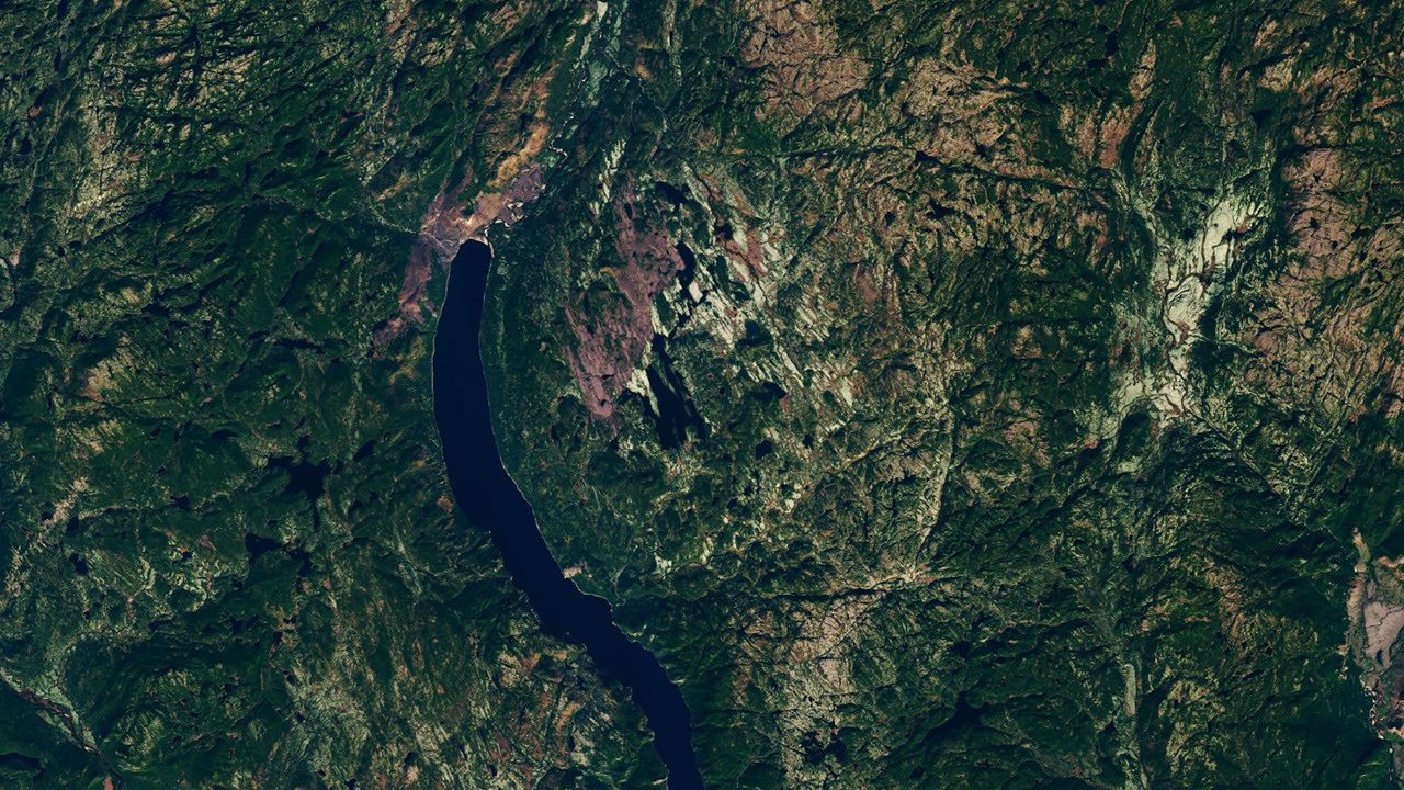
A 25-kilometer-diameter crater, hidden for centuries in the heart of the Quebec forest, has just been confirmed by geologists. Its discovery owes nothing to a university research program nor to a satellite dedicated to chasing astroblemes. It owes everything to a hiker who, in 2024, was searching for a quiet spot to pitch his tent.
- An amateur astronomer uncovered a 390-million-year-old crater while scanning Google Maps for a Quebec camping site
- Geologists confirmed the impact through cone-shaped percussion marks in the rock and convergent isotopic dating
- Uhackatik, the crater named thus, is the largest discovery since the Hiawatha structure in 2018
A Suspicious Circle Near Lake Marsal
Joël Lapointe, an amateur astronomer, was planning a camping trip in the remote Côte-Nord region. While scanning satellite images to locate a site, he spotted a circular pattern on the online satellite maps near Lake Marsal. Nothing in his background had prepared him for such a discovery.
Intrigued, he trusted the hunch and did not let it slip away. Suspecting the depression could be an impact crater, he reached out to experts in Europe and North America. The effort paid off almost immediately.
His inquiries led a team of French researchers to identify the area as the probable center of an eleventh impact structure in Quebec during a meeting of the Meteorite Society in 2024. It was this alert that eventually mobilized Gordon Osinski, planetary geologist at Western University and director of the Impact Earth database. A note: according to his words reported by ZME Science, the vast majority of public reports “turn out not to be” anything. Lapointe’s report survived the curation.
An Expedition to the Limit of Endurance
Confirming a satellite-based hunch requires stepping onto the ground. In October 2025, a four-person team, including Osinski and the French geophysicist Pierre Rochette, reached the site by seaplane. But the aircraft could not land.
They had to wade through about 50 meters of water while carrying their gear, the plane unable to bring them to shore. Once on solid ground, difficulties only mounted. The terrain proved rough, with swamps, insects, and dense vegetation everywhere.
Six continents. That was Osinski’s field experience prior to this mission.
Despite that experience across six continents, he described this expedition as one of the most challenging of his career. A confession that underscores how isolated the site is, about 100 kilometers north of Magpie.
The Undeniable Evidence
A circle visible from space is not by itself proof of an impact event. Tangible geological clues were necessary, and the terrain provided several.
The structure is large enough to host a complex crater spanning 25 kilometers, with a central uplift and towering cliffs marked by columnar jointing. This central rise, typical of large impacts, is accompanied by an even more decisive clue: the percussion cones. These cone-shaped, branching fractures form in the rock under the passage of a high-pressure shock wave. No other known geological process produces them.
The dating rests on two converging methods. On one hand, the paleomagnetic orientation of the rocks, recorded during a reversal of Earth’s magnetic field. On the other, isotopic lead analysis on zircons trapped in rock melted by the impact. Both converge on a window of 370 to 400 million years, with a central estimate of 390 million years.
The researchers proposed a name after discussions with local representatives. After consulting the Innu council of Ekuanitshit, the research team chose to name the crater Uhackatik.
A discreet Giant in a Very Exclusive Club
Earth holds few traces of its past collisions. There are about 200 confirmed impact structures on the planet, but geologists estimate hundreds more await discovery. Erosion, tectonics, and vegetation erase in a few million years what the Moon has preserved intact for billions of years.
In terms of size, Uhackatik immediately places itself among the world’s top entries. It is the largest impact crater discovered since the 31-kilometer Hiawatha structure, found in 2018 beneath Greenland’s ice. Such a scale, for an object that fell 390 million years ago, is dizzying when scaled to human terms.
Osinski even measured what a comparable event would mean today. An object of similar size striking Quebec would cause “regional devastation on a scale that could wipe major cities off the map, with global climatic impacts.” A remark that puts into perspective the apparent tranquility of Lake Marsal.
The site, however, should not become a training ground for astronauts, despite Osinski’s profile as a member of NASA’s Artemis geology team. The access is too challenging to regard Uhackatik in that role; astronauts training typically take place on the younger and more accessible feature of Kameshtashtan, also known as Mistastin Lake, in Labrador.
The official recognition by the Meteorite Society remains, at this stage, a pending formality. The researchers presented their results at the 88th annual meeting of the society, in Frankfurt, in August 2026, and regard the impact origin as practically established. All the same, a simple stroll on Google Maps, a Sunday spent preparing for camping, was enough to rewrite a line of Quebec’s geological history.
Sources: science.nasa.gov | earth.com | spacedaily.com
