
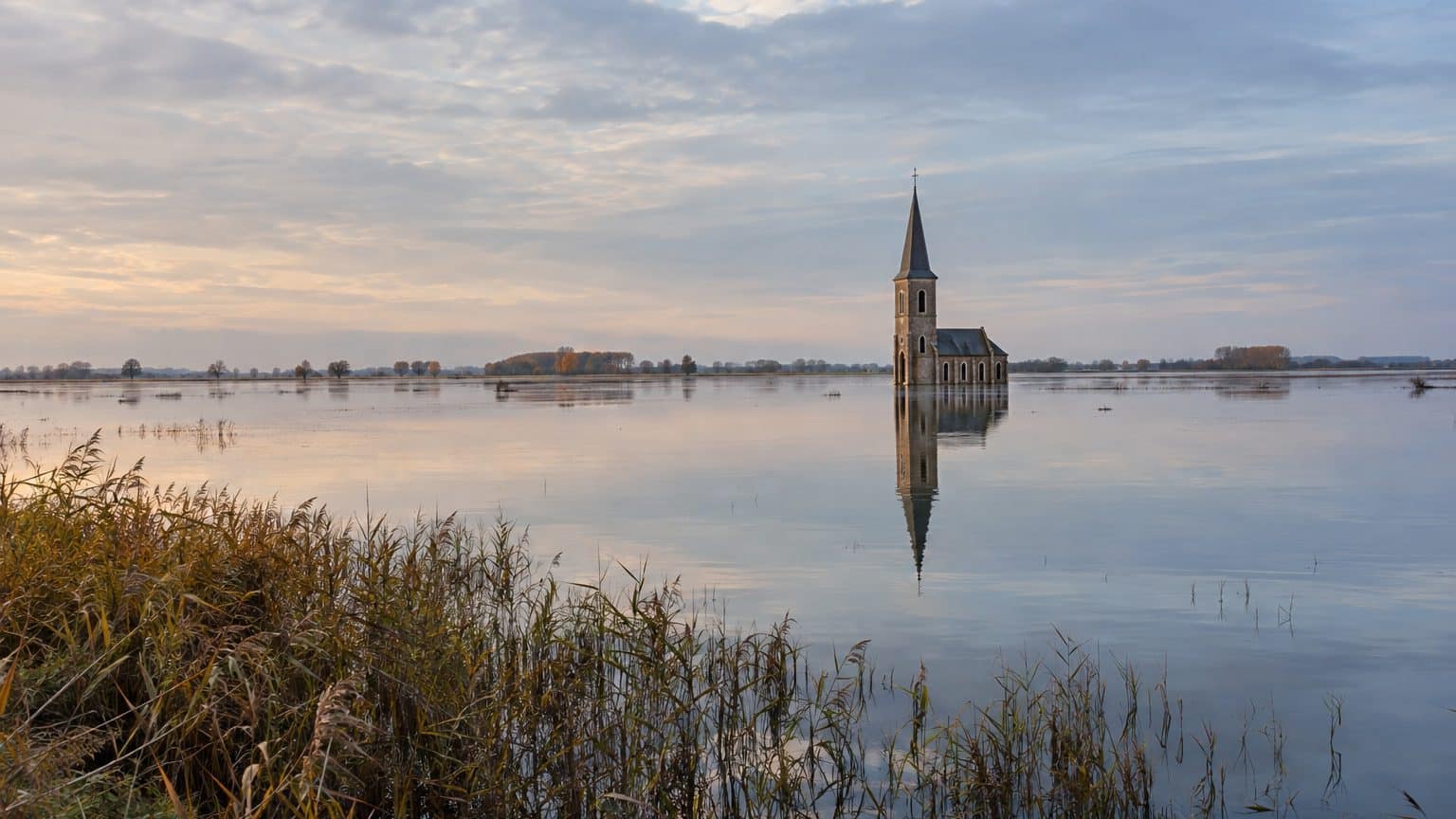
September 1646, at the dawn of the siege of Dunkirk by the French. The Spanish commander of the fortress orders the locks opened to flood the countryside and block the way of the enemy army. The Moëres, a northern village near Dunkirk, then revert to their original state: a sheet of water in which only the church, built in 1632, rises above the surface.
A siege decision undoing three decades of work.
- The Dunkirk locks were opened in September 1646 to flood the Moëres in response to the French army.
- The marsh had been drained at the beginning of the 17th century thanks to 23 windmills.
- Today, about 1,000 inhabitants live 2.5 m below sea level, thanks to pumping.
A peat basin wedged behind the dunes
Between Dunkirk and Veurne (Veurne, on the Belgian side), a thick belt of dunes isolates a wide depression from the sea. Peat deposits several meters thick have accumulated there. The region’s inhabitants used it as fuel, especially in the 12th and 13th centuries, and the records describe this territory as sometimes swamp, sometimes lake.
At the start of the 17th century, Archdukes Albert and Isabella wanted to render these lands exploitable and entrusted the project to engineer Wenceslas Cobergher, who was also a painter and architect, born in Antwerp. The start date varies by source: the Institution of Wateringues cites 1616, while Wikipedia suggests 1617 or 1619 depending on the page. The prudent approach is to say that work began in 1616 or shortly after, and continued into the mid-1620s.
The principle is captured in one image: a ring and wings. A dike, reinforced by a ditch-dike called Ringsloot, encircles the entire marsh, and 23 windmills lift the water to discharge it into this ditch. These mills did not grind grain. Their sole task was to raise water from one level to another, day after day, driven by the wind.
The wager pays off: you build, you live, you cultivate.
September 1646: water as a barrier
The region is then a permanent battlefield. France and Spain have clashed there for nearly two centuries, from the rivalry between Francis I and Charles V to the wars of Louis XIV. In a flat country, the Marquis of Leyde, who commands Dunkirk for the king of Spain, chooses the cheapest weapon: open the locks and let the countryside drown beneath the advancing army.
The headline speaks of thirty years of mills, and the count depends on the source. From 1616 to 1646 there are 30. If one starts from 1619, the number drops to 27. The lands, meanwhile, had only been drained, settled, and cultivated for about twenty years at the moment of the flood.
What remains after the locks open? A church that rises above, nothing more. The marsh returns to marsh, and the timetable for restoration stretches out: drainage only resumes in 1758. More than a century separates 1646 from this revival, but the exact state of the lands in the interim varies according to accounts, and further floods (1648, 1658, 1707) punctuate the period.
Eight floods in three centuries, then the turning point of 1946
The 1646 episode is no exception. The Wateringues Institution records strategic floods in 1646, 1648, 1658, 1707, 1793, 1918, 1940 and 1944. Each conflict that passes through Maritime Flanders reminds us that this territory empties or fills according to the needs of a military staff.
Eight times in three centuries, water has served as a weapon.
The sequence closes in 1946. The Wateringues Institution speaks of the “permanent non-waterlogging of the Moëres” after the German floods of the war. Since then, no military staff has reopened the sluices.
Today: 1,000 inhabitants at 2.50 m below sea level
The average elevation of the Moëres sits at −2.5 m, i.e., 2.5 meters below the usual ceiling height of a standard apartment, but in negative terms. About 1,000 people live in this basin. The mills have disappeared, replaced by pumping stations, and the principle remains unchanged: rainwater and runoff must continually be discharged toward the sea.
That comes at a cost. The annual budget of the Wateringues Institution ranges between 5 and 6 million euros, and residents contribute about 30 euros per hectare per year. On the water side, a franceinfo report indicates that roughly 15% of the volume is pumped, the rest flowing away naturally at low tide. Pumping thus serves only to supplement what the tide already allows.
For the former mayor interviewed by franceinfo in 2021, the rule is simple: “We will have to pump, and pump again.” The line applies to the present as well as the future, since rising sea levels will only make the stations’ task heavier.
This 2021 report describes a village already preparing for this sea-level rise. The Moëres were drowned by war, then permanently drained in 1946. It remains to be seen whether the sea, in turn, will one day reclaim what poldering has taken from it.
Sources: peren-revues.fr | fr.wikipedia.org
